Weston Bend State Park
West Ridge Trail

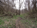
West Ridge Trail is a mixture of long views of the Missouri River and curved explorations along a heavily wooded valley. This is a pretty walk in the spring, and I would imagine it's incredible in the fall when the leaves are in full color.
- Approach
-
From the intersection of I435 and Mo-45N (Tom Watson Pkwy) northwest of Kansas City, follow Mo-45N north and west for 14.2 miles to the Weston Bend park entrance road.
Turn left into the park, and follow the park road 1.1 miles to the turnoff for the Overlook.
Take a left onto the overlook turnoff, and go 0.15 miles to the parking lot.
Coordinates for the hike: 39.3882170,-94.8794310
- Parking / Trailhead amenities
- The parking lot is paved and smooth. Their are no restrooms or water available at the parking lot or at the trailhead.
There is a place for trail brochures at the trailhead, but when I visited it was empty. - Trail observations
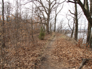
- The trail is paved for a short distance, then turns to dirt and runs along a bluff overlooking the Missouri. At the one mile mark the trail starts to drop down into a valley away from the river, and at about a mile and a half the trail joins with the paved bike path. You will be on the bike path for about 8/10's of a mile, a walk with a lot of short ascents and descents. At about 2.4 miles you will leave the bike path and start a gradual climb up a valley back to the parking lot.
The generally peaceful quiet of the blufftop trail is sometimes interrupted when a train runs along the trail at the base of the bluff - I didn't find this especially intrusive as it seemed a part of the river tableau.
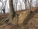
The trail is wide enough for two people to walk side by side in most spots. It's in generally good condition with a single exception where the trail crosses a root and drops a couple feet via a very muddy incline. - Trail statistics
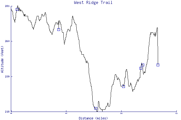
- The trail is 2.66 miles long. The sum of all the uphill climbs is 164 feet.
- Trail waypoints
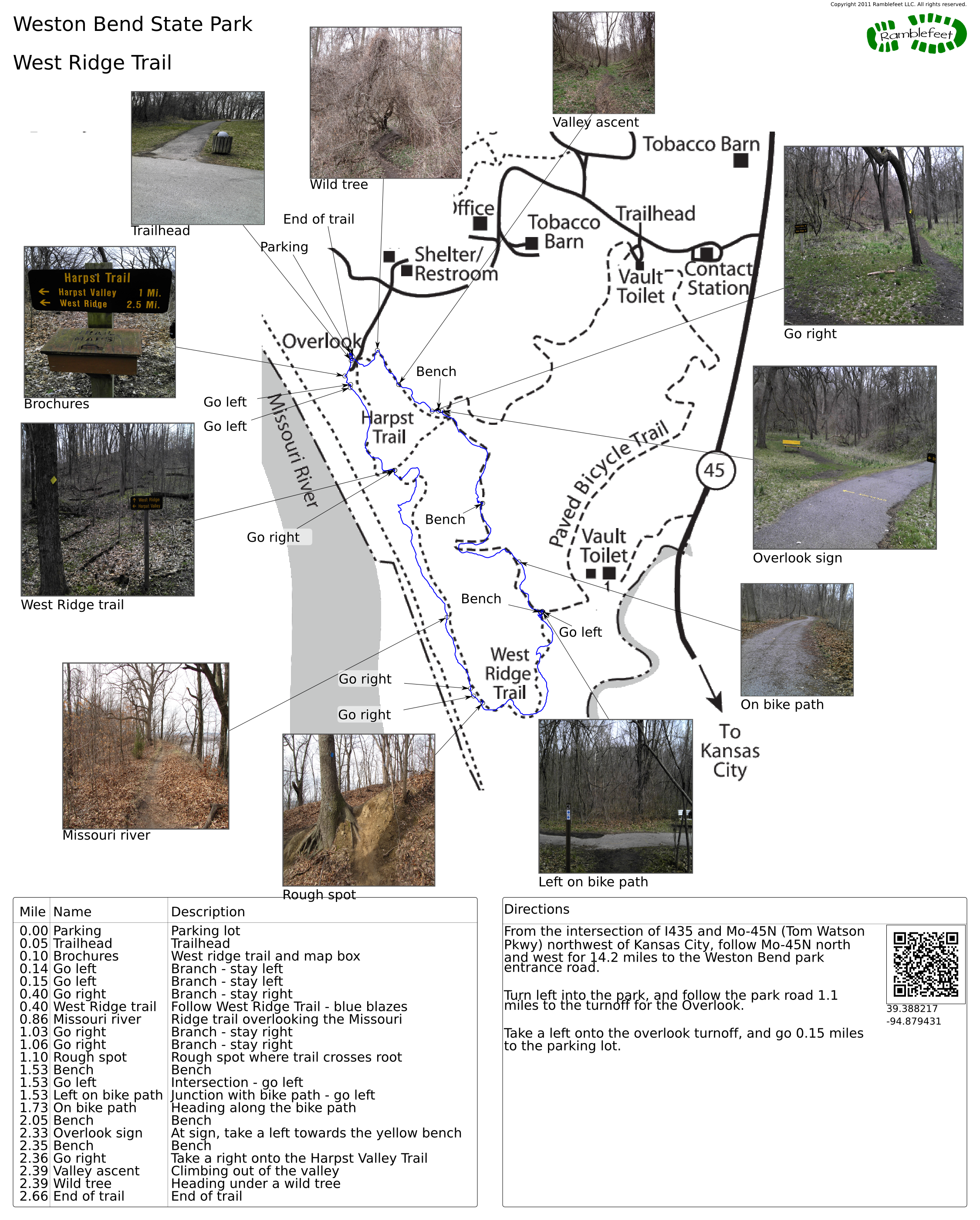
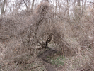
0.00 mi Parking Parking lot 0.05 mi Trailhead Trailhead 0.10 mi Brochures West ridge trail and map box 0.14 mi Go left Branch - stay left 0.15 mi Go left Branch - stay left 0.40 mi Go right Branch - stay right 0.40 mi West Ridge trail Follow West Ridge Trail - blue blazes 0.86 mi Missouri river Ridge trail overlooking the Missouri 1.03 mi Go right Branch - stay right 1.06 mi Go right Branch - stay right 1.10 mi Rough spot Rough spot where trail crosses root 1.53 mi Bench Bench 1.53 mi Go left Intersection - go left 1.53 mi Left on bike path Junction with bike path - go left 1.73 mi On bike path Heading along the bike path 2.05 mi Bench Bench 2.33 mi Overlook sign At sign, take a left towards the yellow bench 2.35 mi Bench Bench 2.36 mi Go right Take a right onto the Harpst Valley Trail 2.39 mi Valley ascent Climbing out of the valley 2.39 mi Wild tree Heading under a wild tree 2.66 mi End of trail End of trail
- Keywords
- Difficulty: Easy
- Terrain : Hilly
- Trail surface: Dirt
- Trail surface: Paved
- Type: Lollipop
- Type: Loop
- Type: Out-and-back
- View: Open
- View: Wooded
- County: Platte County
- State: Missouri
- Country: United States of America
- Resources
- Printable trail map in PDF format (20 Mb download)
- Printable trail map in PNG format (4 Mb download)
- Waypoints in CSV format
- Waypoints in KML format
- Instructions on using a trail description page
- Instructions on using a trail map printout
- Trails in the surrounding area
- Area map for Iowa, Kansas, Missouri, and Nebraska (1 additional trail)
- Area map for Iowa, Kansas, Missouri, and Nebraska (No additional trails)
- Area map for Kansas, Missouri, and Oklahoma (1 additional trail)
- Area map for Kansas, Missouri, and Oklahoma (No additional trails)
Copyright © 2011 RambleFeet LLC. All rights reserved.