Using a trail map printout
Each trail description page has two links in the Resources section at the bottom for printable trail maps, one in PNG format, and the other in PDF format. The two pages have exactly the same content, the only reason there are two formats are to double your chances of getting a usable printout. Use the one that best works for you!.
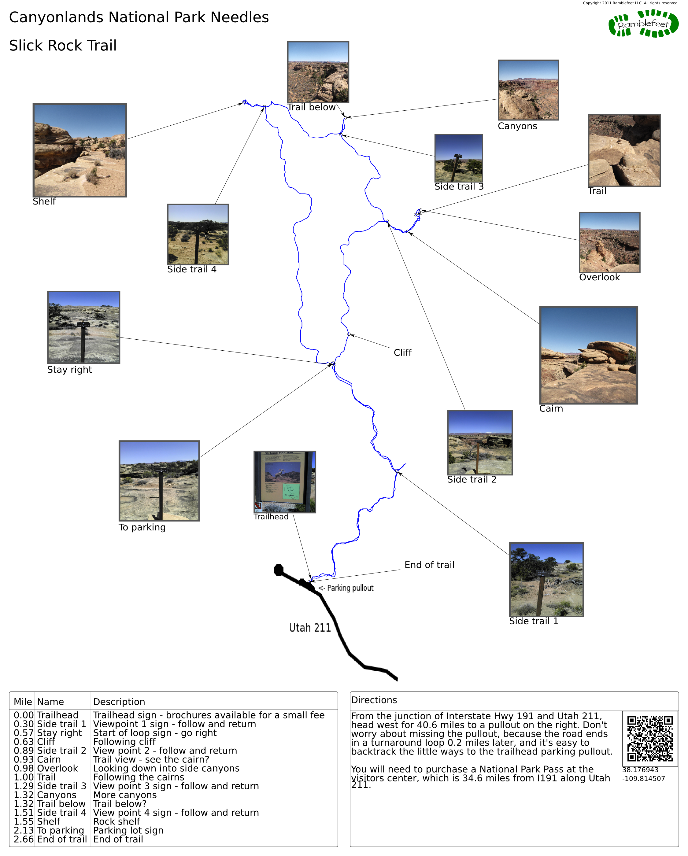
The goal of the trail map printout is to have all the information you need to get to the trailhead and be able to follow the trail detailed in the trail description. There are 3 main sections in the trail map printout.
The main section is the actual map - on it you will find a blue wiggly line that represents the actual path along the trail I took, as recorded by my GPS. In general it is quite accurate, though sometimes it wobbles around a bit as the GPS sometimes loses it's fix on a satellite. Some of the wobbles are me going off trail to explore things...
Also on the map you will see labels with arrows pointing to locations on the trail. These labels correspond to the Name column in the waypoint guide in the lower left corner of the trail map. Some of the labels have pictures attached - hopefully the pictures will help in assuring you that you are where you hope to be.
To use the map, find the 'Trailhead' label on the map - this is where the hike begins. Look at the Name column in the waypoint guide in the lower left to find the label of the next stop on the trail, then locate that same label on the map. In this manner you can navigate the entire trail by following the waypoints in sequence.
The second section of the map is the Waypoint guide in the lower left corner of the trail map. The guide has three columns: Mile, which tells you the number of miles you've travelled to reach that waypoint (as determined by my GPS). Name, which contains a brief label of a waypoint that corresponds to the same label on the map. In trivial cases where the label is a simple direction, like 'Stay right', the label may be repeated - this is intentional as trying to come up with creative ways to give simple directions is bound to be confusing. The third column is the Description - here I will try to point out what is significant about the waypoint - unfortunately, this is often too brief as space on the trail map is limited.
The final section is the Directions guide. The directions guide will give turn by turn directions from a nearby town to the trailhead. Because the nearby town may not be where you are starting from, the actual coordinates of the trailhead are encoded in the QR code as well as printed below for use with a navigation device like a Smartphone, TomTom, or Garmin Nuvi.