Red Rock Falls County Park
Wandering Around

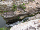
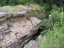
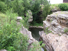
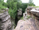
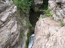
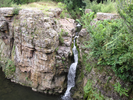
Red Rock Falls is a small county park in south central Minnesota. In the midst of the prairie is a tiny wonderland of waterfalls, steep cliffs, and carved stone.
This is a nice place to stop if you are visiting Jeffers Petroglyphs, or are traveling along Interstate Highway 71 in southern Minnesota and need a short break.
There is quiet and there is beauty here, and what else is really needed?
- Approach
-
From the junction of MN-19 and Interstate Hwy 71 in Redwood Falls, Minnesota, head south along I71 for 29.2 miles to 250 St.
At 250th St, turn left and head east 0.8 miles. The parking lot for Red Rock Falls will be on your left.
From Jeffers Petroglyphs, head north on Cty Rd. 2 to Hwy 10.
At Hwy 10, take a left and follow it west for 3.0 miles to Interstate Hwy 71.
At Hwy 71, take a right and head north 1.0 miles to 250th St.
At 250 St, take a right and head east 0.8 miles. The parking lot will be on your left.
Coordinates for the hike: 44.1222950,-95.1052120
- Parking / Trailhead amenities
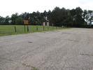
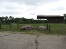
- There is a gravel parking lot with room for several cars at the park. There is a swingset and a teeter-totter in a small playground, a picnic shelter, and pit toilets.
- Trail observations
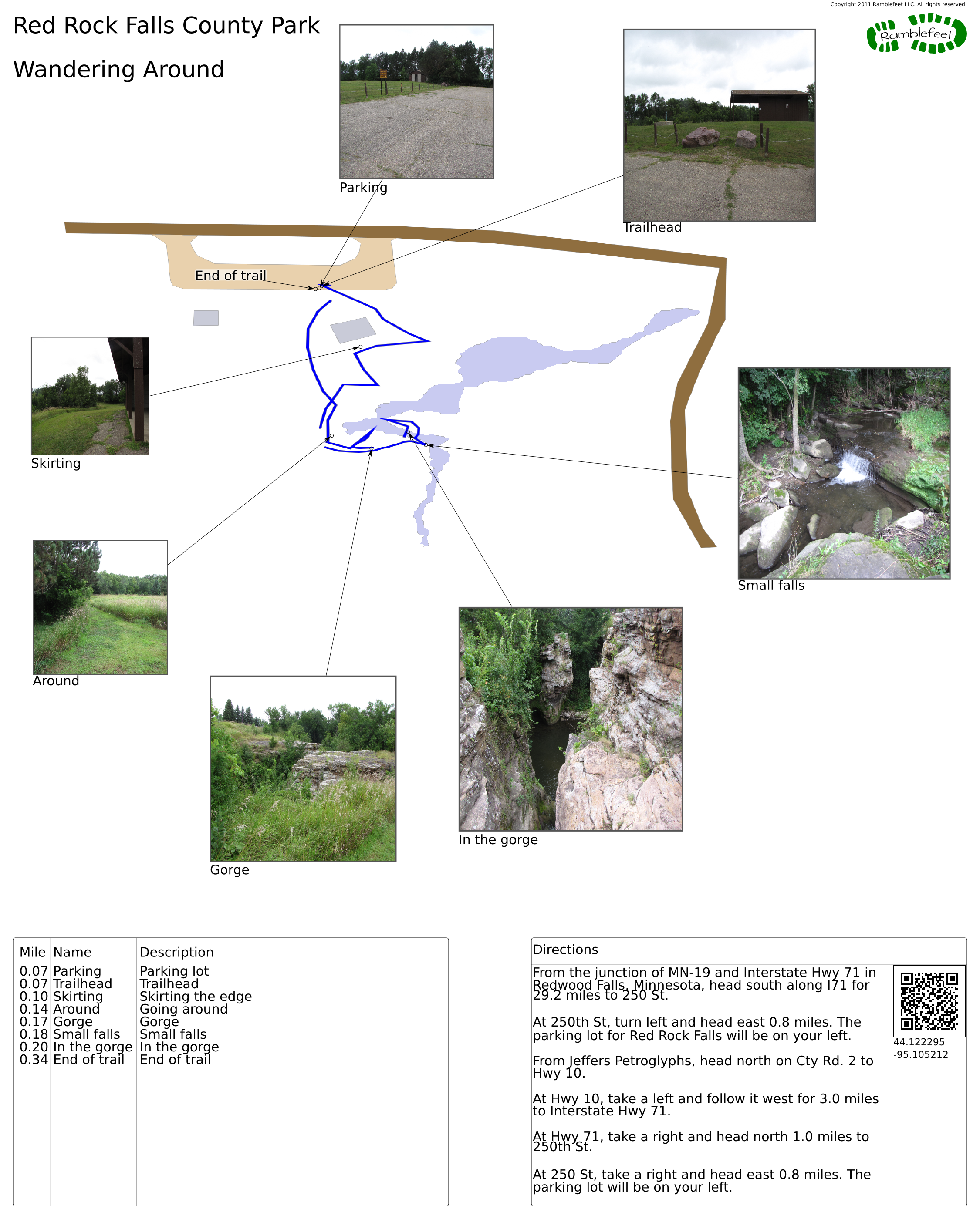
- There isn't really a trail to follow, simply sights to see. From the parking lot, head to the left of the shelter and when you crest the small rise, you will see the dells. You can get to the other side of the dells by heading right and following the perimeter of the small gorge.
Take your time - there are lots of little things to see. Watch out for poison ivy if you leave the mowed areas. I saw a lot of it when I was there. - Trail statistics
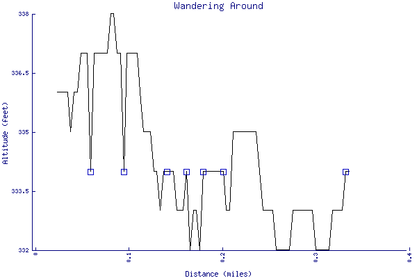
- The trail is 0.34 miles long. The sum of all the uphill climbs is 14 feet.
- Trail waypoints
0.07 mi Parking Parking lot 0.07 mi Trailhead Trailhead 0.10 mi Skirting Skirting the edge 0.14 mi Around Going around 0.17 mi Gorge Gorge 0.18 mi Small falls Small falls 0.20 mi In the gorge In the gorge 0.34 mi End of trail End of trail
- Keywords
- Difficulty: Easy
- Terrain : Flat
- Trail surface: Grassy
- Type: Out-and-back
- View: Open
- County: Cottonwood
- State: Minnesota
- Country: United States of America
- Resources
- Printable trail map in PDF format (15 Mb download)
- Printable trail map in PNG format (2 Mb download)
- Waypoints in CSV format
- Waypoints in KML format
- Instructions on using a trail description page
- Instructions on using a trail map printout
- Trails in the surrounding area
- Area map for Minnesota, North Dakota, and South Dakota (3 additional trails)
- Area map for Minnesota, North Dakota, South Dakota, and Wisconsin (6 additional trails)
- Area map for Iowa, Minnesota, Nebraska, and South Dakota (3 additional trails)
- Area map for Iowa, Minnesota, Nebraska, and South Dakota (5 additional trails)
Copyright © 2011 RambleFeet LLC. All rights reserved.