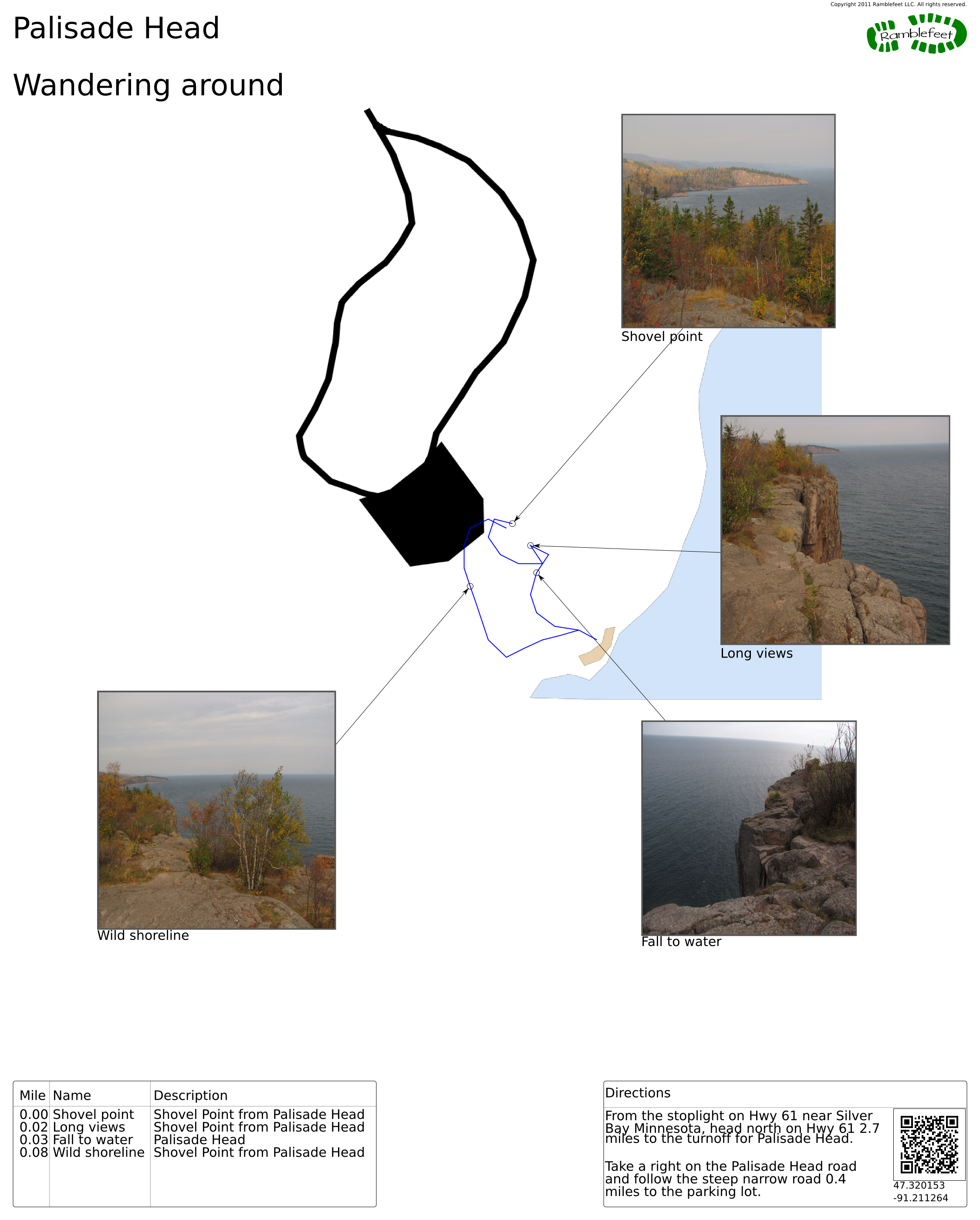
Palisade Head
Wandering around
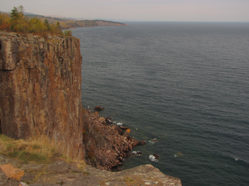
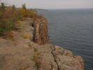
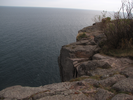
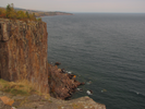
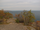
Palisade Head is a must see stop along the North Shore of Lake Superior in Minnesota.
The short steep drive from Highway 61 will give you amazing views of the cliffs and shoreline of this part of Lake Superior.
- Approach
-
From the stoplight on Hwy 61 near Silver Bay Minnesota, head north on Hwy 61 2.7 miles to the turnoff for Palisade Head.
Take a right on the Palisade Head road and follow the steep narrow road 0.4 miles to the parking lot.
Coordinates for the hike: 47.3201530,-91.2112640
- Parking / Trailhead amenities
- The parking lot is paved, level, and has an amazing view. There are no facilities near the parking lot.
- Trail observations
- There isn't any trail to follow - just wander around and admire the view.
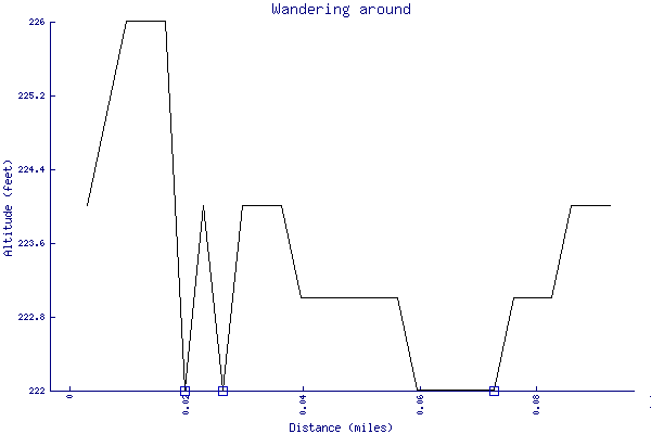
- Trail statistics
- The trail is 0.09 miles long. The sum of all the uphill climbs is 4 feet.
- Trail waypoints
0.00 mi Shovel point Shovel Point from Palisade Head 0.02 mi Long views Shovel Point from Palisade Head 0.03 mi Fall to water Palisade Head 0.08 mi Wild shoreline Shovel Point from Palisade Head
- Keywords
- Difficulty: Easy
- Terrain: Mountainous
- Trail surface: Rock
- Type: Loop
- View: Open
- View: Overlooks
- View: Shoreline
- County:
- State:
- Country:
- Links
- Wikipedia article
- Resources
- Printable trail map in PDF format (6 Mb download)
- Printable trail map in PNG format (2 Mb download)
- Waypoints in CSV format
- Waypoints in KML format
- Instructions on using a trail description page
- Instructions on using a trail map printout
- Trails in the surrounding area
- Trailheads for Minnesota and Wisconsin (1 additional trail)
- Trailheads for Michigan Minnesota, and Wisconsin (1 additional trail)
- Trailheads for Minnesota and Wisconsin (6 additional trails)
- Trailheads for Michigan Minnesota, and Wisconsin (1 additional trail)
Copyright © 2011 RambleFeet LLC. All rights reserved.