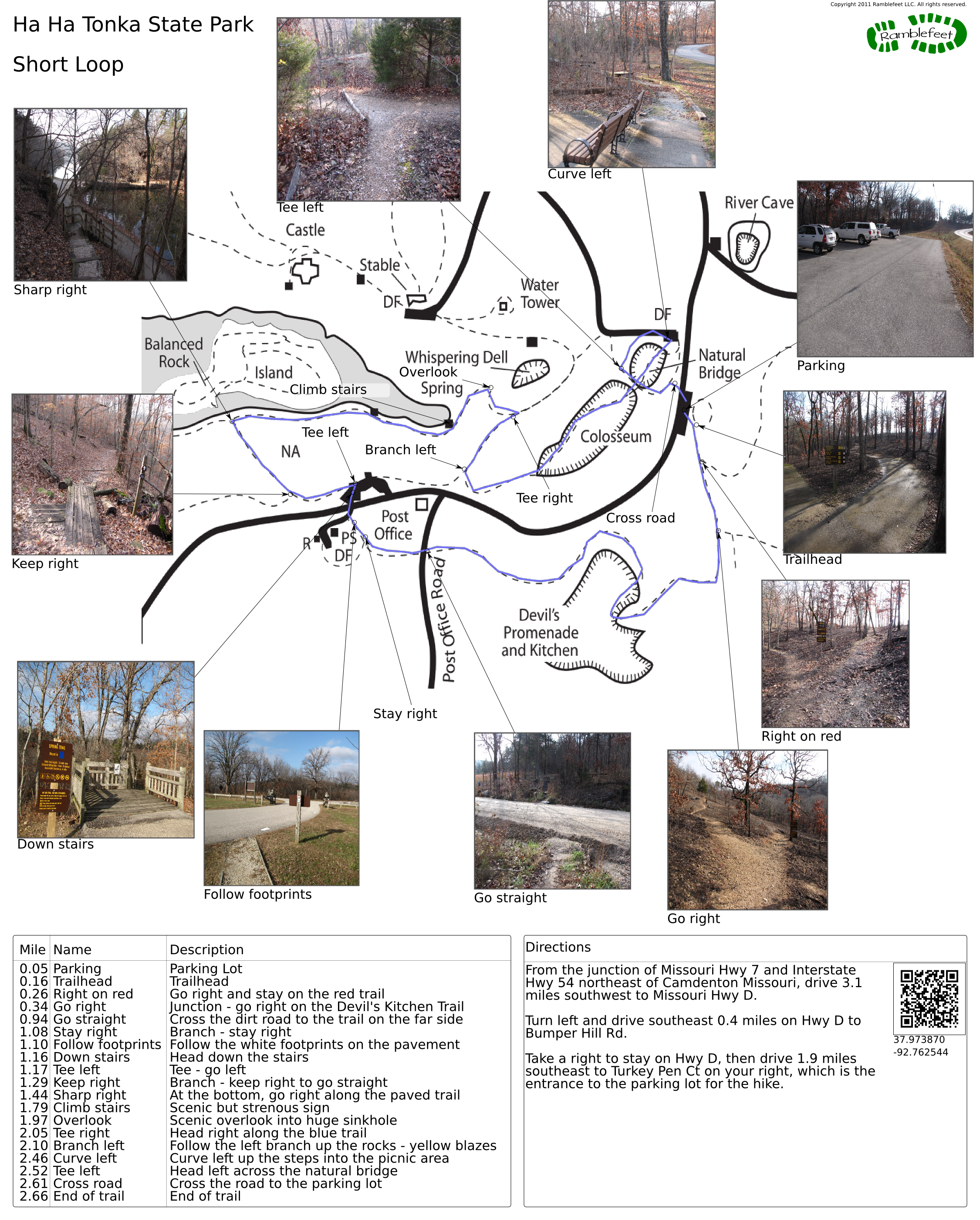
Ha Ha Tonka State Park
Short Loop

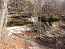
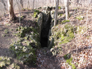
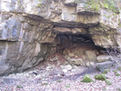
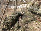
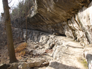
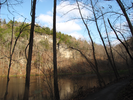
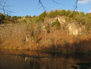
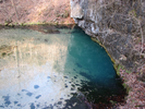
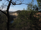
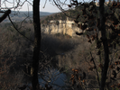
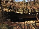
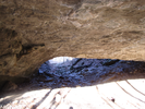
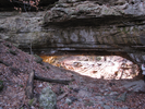
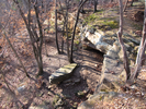
The trail on this page explores a good sampling of the extensive karst topography of Ha Ha Tonka State Park. The trail curves through the Devils Kitchen, a remote feeling area of undercut cliffs and a rock house/natural bridge, then follows a shoreline section of Ha Ha Tonka spring and ends with a traverse of the Colosseum and an enormous natural bridge.
Ha Ha Tonka is a place of long views and intricate scenery. There is an amazing mix of cultural and natural elements to explore. This is a park worth visiting many times - the hike on this page is just a sample of what you will find there!
- Approach
-
From the junction of Missouri Hwy 7 and Interstate Hwy 54 northeast of Camdenton Missouri, drive 3.1 miles southwest to Missouri Hwy D.
Turn left and drive southeast 0.4 miles on Hwy D to Bumper Hill Rd.
Take a right to stay on Hwy D, then drive 1.9 miles southeast to Turkey Pen Ct on your right, which is the entrance to the parking lot for the hike.
Coordinates for the hike: 37.9738700,-92.7625440
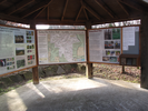
- Parking / Trailhead amenities
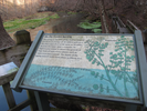
- The paved parking lot is large and a bit tilted. Their is an informational kiosk adjacent to the parking lot and no other amenites. There are flush toilets available at the visitor center 0.4 miles north on Hwy D.
- Trail observations
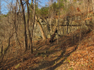
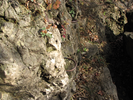
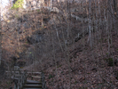
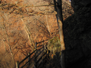
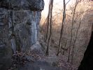
- The trail leaves the parking lot near the kiosk. The trail is paved for a few feet after the first junction, then turns to gravel and dirt, with frequent rocky extrusions. Walking the Devils Kitchen section of the hike can be tough at times due to the slippery rock surfaces along some parts of the path.
There is one place along the trail that made my ten year old son nervous as it involved a step across a gap a bit larger than he could comfortably make. There are metal handholds at the spot that probably would have helped if we had crossed the section a bit differently.
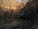
After the Devils Kitchen the trail climbs a ridge to a paved road that runs along Ha Ha Tonka spring. Follow the big white footprints painted on the pavement to reach the continuation of the trail on the far side.
The hike descends to the water level in the spring, follows a short walk on a paved path along the spring, then ascends via a long series of fun wooden staircases. From there the hike descends into the Colosseum and under the natural bridge, then loops back to cross over the natural bridge to the Turkey Pen parking lot. - Trail statistics
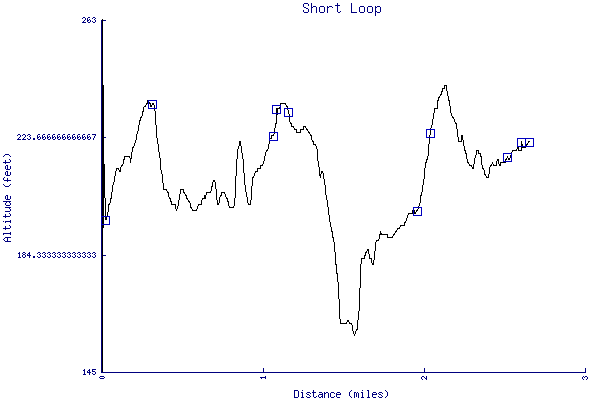
- The trail is 2.66 miles long. The sum of all the uphill climbs is 381 feet.
- Trail waypoints
0.05 mi Parking Parking Lot 0.16 mi Trailhead Trailhead 0.26 mi Right on red Go right and stay on the red trail 0.34 mi Go right Junction - go right on the Devil's Kitchen Trail 0.94 mi Go straight Cross the dirt road to the trail on the far side 1.08 mi Stay right Branch - stay right 1.10 mi Follow footprints Follow the white footprints on the pavement 1.16 mi Down stairs Head down the stairs 1.17 mi Tee left Tee - go left 1.29 mi Keep right Branch - keep right to go straight 1.44 mi Sharp right At the bottom, go right along the paved trail 1.79 mi Climb stairs Scenic but strenous sign 1.97 mi Overlook Scenic overlook into huge sinkhole 2.05 mi Tee right Head right along the blue trail 2.10 mi Branch left Follow the left branch up the rocks - yellow blazes 2.46 mi Curve left Curve left up the steps into the picnic area 2.52 mi Tee left Head left across the natural bridge 2.61 mi Cross road Cross the road to the parking lot 2.66 mi End of trail End of trail


- Keywords
- Difficulty: Moderate
- Terrain: Canyon
- Terrain: Hilly
- Trail surface: Boardwalk
- Trail surface: Dirt
- Trail surface: Gravel
- Trail surface: Paved
- Trail surface: Rock
- Type: Loop
- View: Enclosed
- View: Overlooks
- View: Shoreline
- View: Wooded
- County: Camden County
- State: Missouri
- Country: United States of America
- Links
- Missouri State Parks site (Check out the video!)
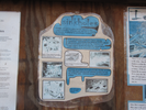
- Conceptual map (PDF)
- Excellent and thorough blog post about the park
- Another excellent writeup
- Resources
- Printable trail map in PDF format (33 Mb download)
- Printable trail map in PNG format (5 Mb download)
- Waypoints in CSV format
- Waypoints in KML format
- Instructions on using a trail description page
- Instructions on using a trail map printout
- Trails in the surrounding area
- Trailheads for Kansas Missouri, and Oklahoma (No additional trails)
- Trailheads for Illinois and Missouri (No additional trails)
- Trailheads for Arkansas Kansas, Missouri, and Oklahoma (1 additional trail)
- Trailheads for Arkansas Illinois, Missouri, and Tennessee (1 additional trail)
Copyright © 2011 RambleFeet LLC. All rights reserved.