Canyonlands National Park Needles
Slick Rock Trail
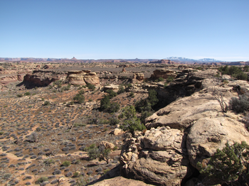
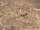
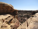
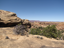
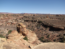
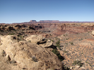
The Slick Rock Trail is a nice hike along the slickrock tablelands that lie between Big Spring Canyon and Little Spring Canyon. Throughout the hike you can see long distances, and frequently you can look down into the canyons.
Almost the entire trail is on rock, sometimes gently rolling and sometimes flat. The hike is serene and quiet and the views are long and gorgeous.
- Approach
-
From the junction of Interstate Hwy 191 and Utah 211, head west for 40.6 miles to a pullout on the right. Don't worry about missing the pullout, because the road ends in a turnaround loop 0.2 miles later, and it's easy to backtrack the little ways to the trailhead parking pullout.
You will need to purchase a National Park Pass at the visitors center, which is 34.6 miles from US-191 along Utah 211.
Coordinates for the hike: 38.1769430,-109.8145070
- Parking / Trailhead amenities
- Parking for the Slickrock trail is at a pullout off of Utah 211. There is room for about 8 cars in the pullout, and if it is full, there is a bigger parking lot about 2/10's of a mile down the road.
There is a trail board at the trailhead, along with some brochures that can be purchased for a small fee.
There are no facilities at the trailhead. I would recommend carrying water on this hike, as there is almost no shade along the trail. - Trail observations
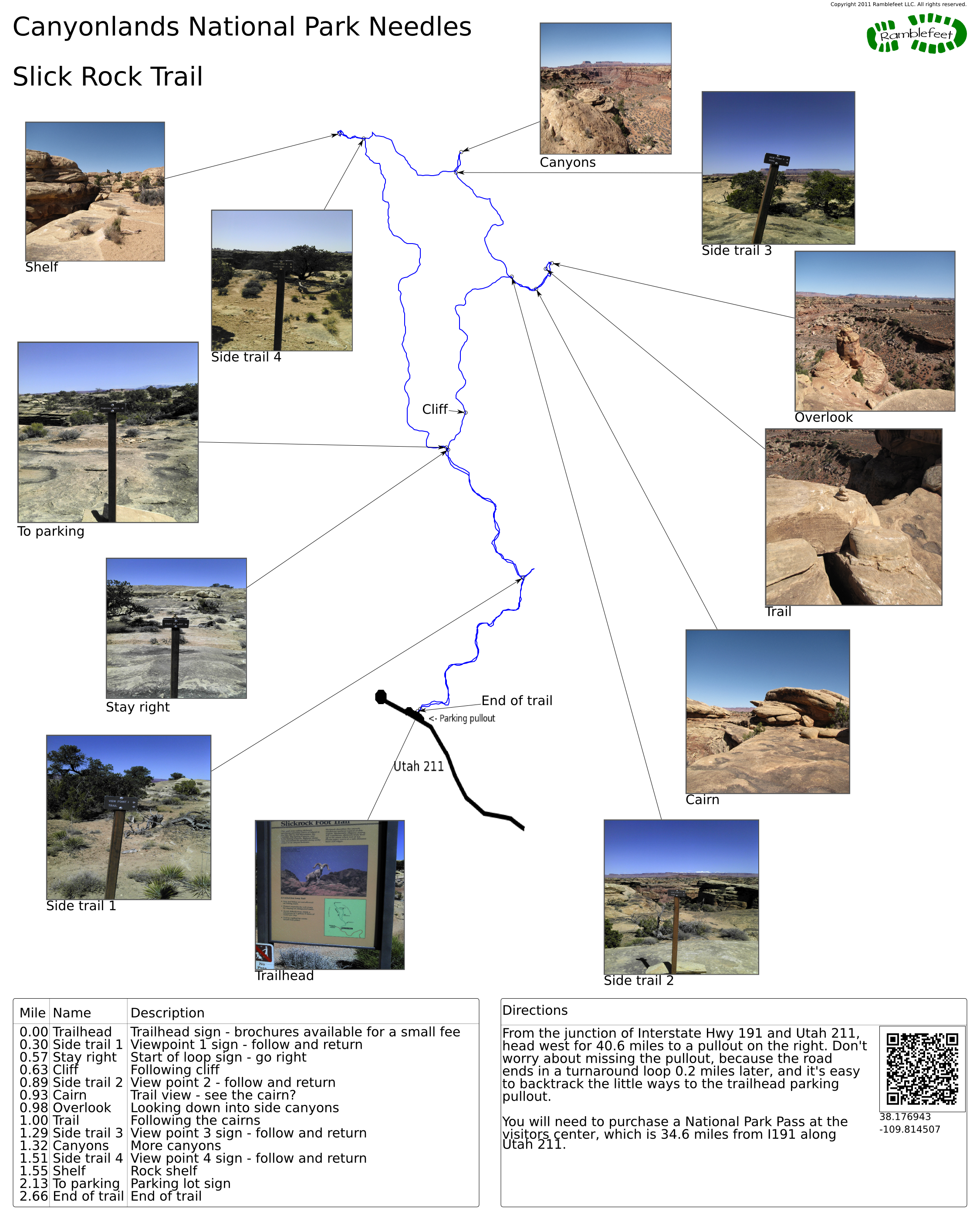
- The trail exits from the parking pullout. The trail is a lollipop, with the loop section of the trail starting 0.6 miles from the trailhead. The trail is easy though it can be very hot - luckily there is often a breeze as the terrain the trail crosses is high and there is nothing to break the wind.
Along the trail are 4 side trails that lead to viewpoints. These trails are generally short and worth following. After visiting a viewpoint, retrace your steps to where you left the main trail and continue from there. - Trail statistics
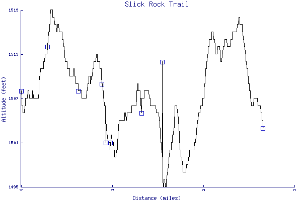
- The trail is 2.66 miles long. The sum of all the uphill climbs is 87 feet.
- Trail waypoints
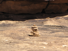
0.00 mi Trailhead Trailhead sign - brochures available for a small fee 0.30 mi Side trail 1 Viewpoint 1 sign - follow and return 0.57 mi Stay right Start of loop sign - go right 0.63 mi Cliff Following cliff 0.89 mi Side trail 2 View point 2 - follow and return 0.93 mi Cairn Trail view - see the cairn? 0.98 mi Overlook Looking down into side canyons 1.00 mi Trail Following the cairns 1.29 mi Side trail 3 View point 3 sign - follow and return 1.32 mi Canyons More canyons 1.51 mi Side trail 4 View point 4 sign - follow and return 1.55 mi Shelf Rock shelf 2.13 mi To parking Parking lot sign 2.66 mi End of trail End of trail

- Keywords
- Difficulty: Moderate
- Terrain : Canyon
- Trail surface: Rock
- View: Open
- County: San Juan
- State: Utah
- Country: United States of America
- Resources
- Printable trail map in PDF format (14 Mb download)
- Printable trail map in PNG format (3 Mb download)
- Waypoints in CSV format
- Waypoints in KML format
- Instructions on using a trail description page
- Instructions on using a trail map printout
- Trails in the surrounding area
- Trailheads for Colorado and Utah (4 additional trails)
- Trailheads for Colorado and Utah (4 additional trails)
- Trailheads for Arizona Colorado, New Mexico, and Utah (4 additional trails)
- Trailheads for Arizona Colorado, New Mexico, and Utah (4 additional trails)
Copyright © 2011 RambleFeet LLC. All rights reserved.