Barn Bluff
All trails

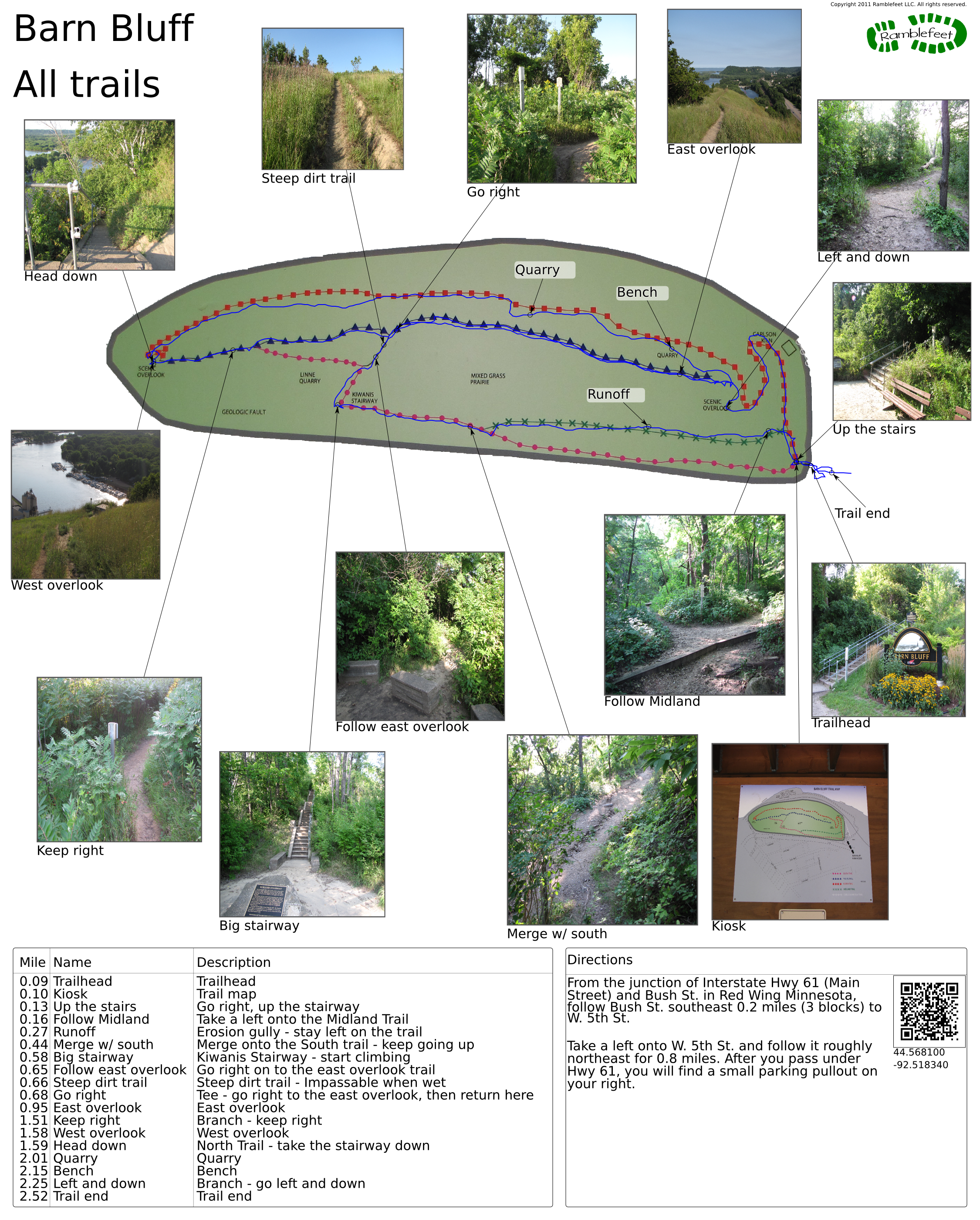
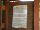
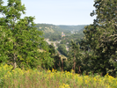
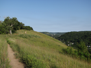
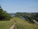
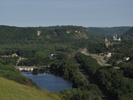
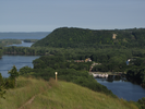
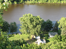
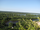
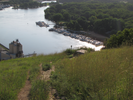
Barn Bluff is a colossal detached bluff that provides commanding views of the Mississippi River and the town of Red Wing. There are three main trails on the bluff, and this hike will follow all of them.
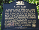
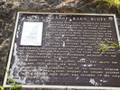
There is a quote from Jonathan Carver on one of the many informational signs along the trail that sums things up best:
"The most beautiful prospect that imagination can form. Verdant plains, fruitful meadows, and numerous islands abound with the most varied trees... But above all, reaching as far as the eye can extend, is the majestic, softly flowing river".
- Approach
-
From the junction of Interstate Hwy 61 (Main Street) and Bush St. in Red Wing Minnesota, follow Bush St. southeast 0.2 miles (3 blocks) to W. 5th St.
Take a left onto W. 5th St. and follow it roughly northeast for 0.8 miles. After you pass under Hwy 61, you will find a small parking pullout on your right.
Coordinates for the hike: 44.5681000,-92.5183400
- Parking / Trailhead amenities
- The parking lot is a simple gravel pullout off of E. 5th Street. There is room for only a small number of cars. There are no facilities near the parking lot or along the trail.
- Trail observations
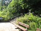
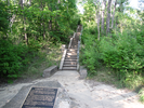
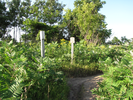
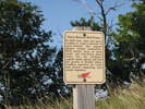
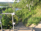
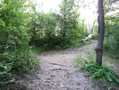
- The trailhead starts directly across 5th street. Ascend the flight of stairs - at the top you will find a kiosk that provides a wealth of information.
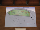
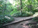
From the kiosk you will be heading uphill to pick up the Midland Trail. I like to hike the Midland trail rather than the wider South trail because the highway noise along the South trail can reach painful levels.
The Midland trail merges with the southland trail after it's climbed about 1/4 of the height of the bluff.
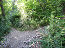
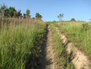
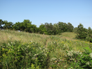
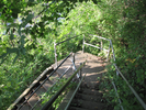
From there you will take the South trail to the Prairie trail, first to the east overlook, then to the west overlook, finally returning on the far side of the bluff via the North trail. Note that the Prairie trail is usually draped in prairie grass which can be a bit sharp. I strongly recommend wearing long pants.
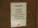
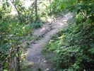
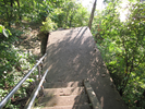
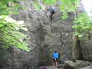
Do NOT do this trail if it has been raining recently. The section of dirt trail after the Kiwanis stairway is steep and there is nothing to hold onto to help you climb.
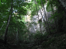
The North trail is also slippery when wet - use good sense when taking this hike! - Trail statistics
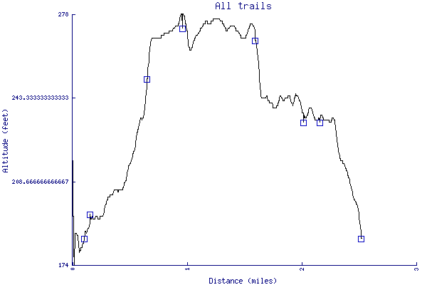
- The trail is 2.52 miles long. The sum of all the uphill climbs is 192 feet.
- Trail waypoints
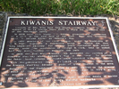
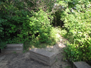
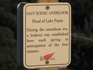
0.09 mi Trailhead Trailhead 0.10 mi Kiosk Trail map 0.13 mi Up the stairs Go right, up the stairway 0.16 mi Follow Midland Take a left onto the Midland Trail 0.27 mi Runoff Erosion gully - stay left on the trail 0.44 mi Merge w/ south Merge onto the South trail - keep going up 0.58 mi Big stairway Kiwanis Stairway - start climbing 0.65 mi Follow east overlook Go right on to the east overlook trail 0.66 mi Steep dirt trail Steep dirt trail - Impassable when wet 0.68 mi Go right Tee - go right to the east overlook, then return here 0.95 mi East overlook East overlook 1.51 mi Keep right Branch - keep right 1.58 mi West overlook West overlook 1.59 mi Head down North Trail - take the stairway down 2.01 mi Quarry Quarry 2.15 mi Bench Bench 2.25 mi Left and down Branch - go left and down 2.52 mi Trail end Trail end


- Keywords
- Difficulty: Difficult
- Terrain : Hilly
- Trail surface: Dirt
- Trail surface: Gravel
- Type: Loop
- View: Open
- View: Wooded
- County: Goodhue
- State: Minnesota
- Country: United States of America
- Resources
- Printable trail map in PDF format (35 Mb download)
- Printable trail map in PNG format (6 Mb download)
- Waypoints in CSV format
- Waypoints in KML format
- Instructions on using a trail description page
- Instructions on using a trail map printout
- Trails in the surrounding area
- Area map for Iowa, Minnesota, and Wisconsin (6 additional trails)
- Area map for Iowa, Michigan, Minnesota, and Wisconsin (3 additional trails)
- Area map for Iowa, Minnesota, and Wisconsin (4 additional trails)
- Area map for Illinois, Iowa, Minnesota, and Wisconsin (4 additional trails)
Copyright © 2011 RambleFeet LLC. All rights reserved.