Arches National Park
Delicate Arch Trail
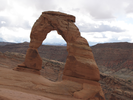
Delicate Arch may be the most rewarding hike I've ever taken. Most of the trail is through amazing beauty, and walking along the waves of slick rock is a tactile joy. Every step seems interesting and unique.
There is a sacred feel along the trail which only increases to something profound when finally you see Delicate Arch. I've done this hike many times, and each time I feel I enjoy it more.
- Approach
-
There is a fee needed to enter Arches National Park, which you can pay at a drive up entrance station immediately after you enter the park from Interstate 191.
From the entrance station, follow the park road 11.6 miles to the Wolfe Ranch Road.
Take a right onto Wolfe Ranch road and follow it for 1.2 miles to the Delicate Arch Parking Lot.
Coordinates for the hike: 38.7356790,-109.5202580
- Parking / Trailhead amenities
- There is a map board with trail brochures, and a couple of pit toilets next to the parking area. The parking lot is paved and there are quite a few spaces available, though I would guess there could be a shortage during the busiest summer months.
- Trail observations
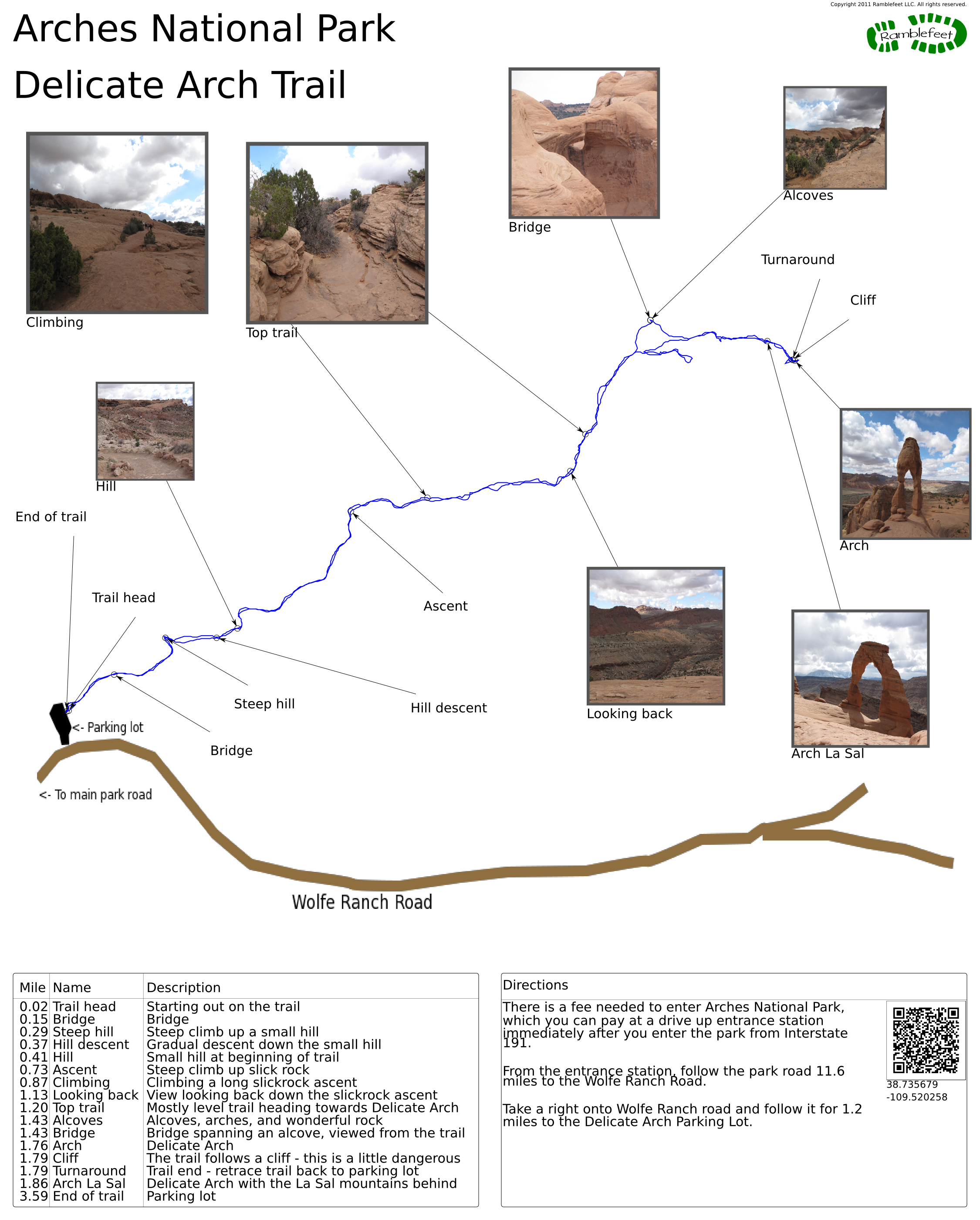
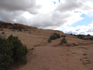
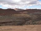
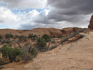
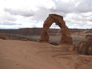
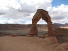
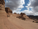
- The trailhead exits directly from the parking lot and is well marked. The first section of the trail is flat for a short ways, then it climbs and descends a hill, then climbs for quite a distance to the top of a slickrock ridge. The trail stays on top of the ridge, gradually ascending till it reaches Delicate Arch. From Delicate Arch, retrace your steps back to the parking lot.
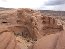
The trail is quite wide as it approaches the slickrock. Once on the slickrock the path is generally as wide as there is room, and you will need to follow the cairns to stay on the trail. There are a few places where there is some exposure to moderately dangerous drops - if you have children, you should keep an eye on them. - Trail statistics
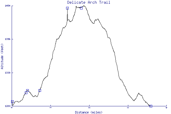
- The trail is 3.59 miles long. The sum of all the uphill climbs is 234 feet.
- Trail waypoints
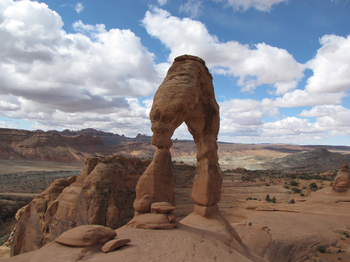
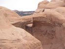
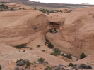
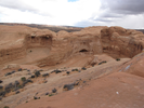
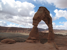
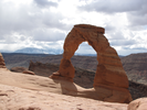
0.02 mi Trail head Starting out on the trail 0.15 mi Bridge Bridge 0.29 mi Steep hill Steep climb up a small hill 0.37 mi Hill descent Gradual descent down the small hill 0.41 mi Hill Small hill at beginning of trail 0.73 mi Ascent Steep climb up slick rock 0.87 mi Climbing Climbing a long slickrock ascent 1.13 mi Looking back View looking back down the slickrock ascent 1.20 mi Top trail Mostly level trail heading towards Delicate Arch 1.43 mi Alcoves Alcoves, arches, and wonderful rock 1.43 mi Bridge Bridge spanning an alcove, viewed from the trail 1.76 mi Arch Delicate Arch 1.79 mi Cliff The trail follows a cliff - this is a little dangerous 1.79 mi Turnaround Trail end - retrace trail back to parking lot 1.86 mi Arch La Sal Delicate Arch with the La Sal mountains behind 3.59 mi End of trail Parking lot

- Keywords
- Difficulty: Moderate
- Terrain : Canyon
- Trail surface: Dirt
- Trail surface: Rock
- View: Open
- County: Grand County
- State: Utah
- Country: United States of America
- Resources
- Printable trail map in PDF format (11 Mb download)
- Printable trail map in PNG format (2 Mb download)
- Waypoints in CSV format
- Waypoints in KML format
- Instructions on using a trail description page
- Instructions on using a trail map printout
- Trails in the surrounding area
- Area map for Colorado and Utah (4 additional trails)
- Area map for Colorado and Utah (4 additional trails)
- Area map for Arizona, Colorado, New Mexico, and Utah (4 additional trails)
Copyright © 2011 RambleFeet LLC. All rights reserved.