Sidie Hollow County Park
Lake Loop Trail
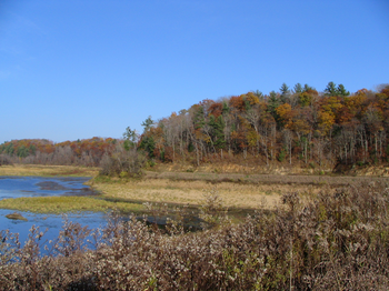
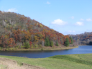
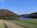
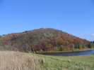
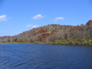
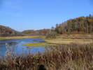
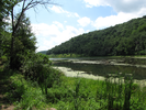
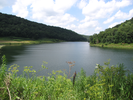
Sidie Hollow is a 521 acre park formed around two valleys cut by streams that have been dammed to form an 'L' shaped lake.
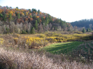
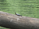
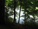
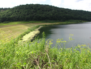
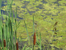
The lake loop trail follows the perimeter of the lake, crossing two bridges and a dam and providing long views of the lake cradled between wooded hills.
The early morning colors of the sun moving into the misty hollows of the valley is dramatic and joyful. This is an easy hike well worth doing.
- Approach
-
From the intersection of WI-56 and Cty Rd. B west of Viroqua Wisconsin, head west 0.6 miles to County Rd XX.
Take a left onto County Rd. XX and follow it 2.8 miles to where County Rd. XX takes a left and heads toward the park office and main campground.
After you have taken the left turn you will still be on County Rd. XX. Follow that 0.7 miles to the parking lot near the trailhead.
Coordinates for the hike: 43.5463450,-90.9602680
- Parking / Trailhead amenities
- The parking lot is a small paved cul-de-sac at the end of the park road with a small number of parking spots. Just before reaching the cul-de-sac there is a larger parking lot that I think is meant for the campsites that are arrayed along the park road as you approach the lake.
There is a restroom with running water and a drinking fountain in the campgrounds a short distance from the parking lot. There is a shelter with picnic tables immediately adjacent to the lot. - Trail observations
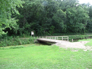
- The trail starts a short distance from the parking lot where a bridge crosses a small stream. The bridge is ahead on your left as you face the lake from the parking lot. From there the trail follows the perimeter of the lake all the way back to the parking lot.
At the midway point of the hike there is a boat launch and campground. - Trail statistics
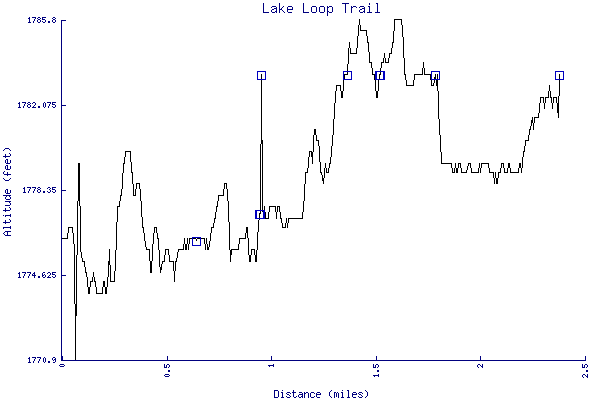
- The trail is 2.38 miles long. The sum of all the uphill climbs is 64 feet.
- Trail waypoints
0.12 mi Parking Parking lot 0.16 mi 1st Bridge Cross the bridge 0.76 mi Bench Bench 0.97 mi Dock Dock 1.09 mi Break Enter meadow at break and follow the stream on your right 1.09 mi Launch Boat launch Parking 1.10 mi 2nd bridge Cross the bridge 1.44 mi Trail Trail view 1.57 mi Overlook Bench overlook 1.57 mi Dam Cross the dam 1.57 mi Long view Looking back towards the trailhead 1.57 mi Benches Benches 1.72 mi Lake trail Follow the trail along the lake 2.38 mi End of trail End of trail


- Keywords
- Difficulty: Easy
- Trail surface: Dirt
- Trail surface: Grassy
- Type: Loop
- View: Open
- View: Shoreline
- View: Wooded
- County: Vernon
- State: Wisconsin
- Country: United States of America
- Links
- A friend brought an incredible cheese dip from this coop - amazing!
- Vernon County's excellent park site
- Resources
- Printable trail map in PDF format (33 Mb download)
- Printable trail map in PNG format (5 Mb download)
- Waypoints in CSV format
- Waypoints in KML format
- Instructions on using a trail description page
- Instructions on using a trail map printout
- Trails in the surrounding area
- Area map for Iowa, Michigan, Minnesota, and Wisconsin (3 additional trails)
- Area map for Illinois, Iowa, Minnesota, and Wisconsin (4 additional trails)
- Area map for Illinois, Iowa, Minnesota, and Wisconsin (-1 additional trail)
Copyright © 2011 RambleFeet LLC. All rights reserved.