Sherburne National Wildlife Refuge
Mahnomen Trail
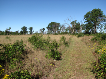
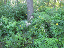
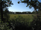
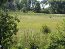
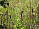
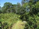
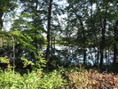
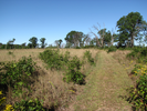
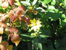
The Mahnomen Trail is a short easy exploration of an in progress Oak Savannah Restoration. The trail winds through patches of forest and out into prairie clearings. In summer there is a wealth of prairie blossoms, and in the fall the prairie grass turns brassy and gold against the brick red of the oak leaves. In winter it is your classic winter wonderland...
This is a trail best walked in the early spring or late fall as there is a plethora of winged biting things. The Sherburne Wildlife Refuge is a place of beauty that can be explored both on foot and by car, and the Mahnomen Trail is a good place to start.
- Approach
-
From the junction of Interstate Highways 169 and 10 south of Elk River Minnesota, head north on 169 14.8 miles to County Rd. 9.
Take the County 9 exit, and at the top turn left and head west 5.1 miles to the Mahnomen Trail parking lot on your left.
Coordinates for the hike: 45.4974740,-93.6851190
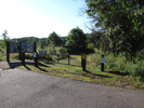
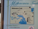
- Parking / Trailhead amenities
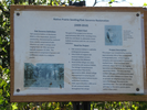
- The parking lot is smooth and paved and has room for about 10 cars. There is a clean pit toilet and a map board with brochures and trail guides adjacent to the parking lot.
- Trail observations
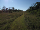
- The trail exits directly from the parking lot near the toilets. The trail is a nearly flat 3 mile loop. The trail is grassy and generally wide enough for two to walk side by side. This is a very easy hike, with plenty of benches and map signs at every junction.
- Trail statistics
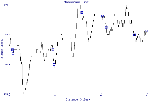
- The trail is 2.99 miles long. The sum of all the uphill climbs is 78 feet.
- Trail waypoints
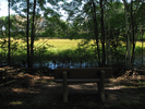
0.01 mi Parking Parking lot 0.07 mi Trailhead Trailhead 0.08 mi Go right Branch - go right 0.27 mi Bench Bench 0.72 mi Stay right Branch - go right 0.96 mi Bench Bench 0.98 mi Keep right Branch - stay right 1.31 mi Bench Sign,Bench 1.61 mi Lake bench Bench overlooking lake 2.04 mi Go straight Intersection - go straight 2.09 mi Stay right Branch - stay right 2.13 mi Trail to bench Side trail to bench 2.25 mi Go right Branch - stay right 2.73 mi Bench Bench 2.99 mi Trail end Trail end

- Keywords
- Difficulty: Easy
- Terrain : Flat
- Trail surface: Grassy
- Type: Loop
- View: Open
- View: Wooded
- County: Sherburne
- State: Minnesota
- Country: United States of America
- Links
- Friends of Sherburne National Wildlife Refuge Blog - this is a cool site!
- Fish and Wildlife Service site
- Refuge map
- Resources
- Printable trail map in PDF format (27 Mb download)
- Printable trail map in PNG format (4 Mb download)
- Waypoints in CSV format
- Waypoints in KML format
- Instructions on using a trail description page
- Instructions on using a trail map printout
- Trails in the surrounding area
- Trailheads for Minnesota North Dakota, South Dakota, and Wisconsin (1 additional trail)
- Trailheads for Minnesota and Wisconsin (2 additional trails)
- Trailheads for Minnesota North Dakota, South Dakota, and Wisconsin (7 additional trails)
- Trailheads for Iowa Minnesota, and Wisconsin (7 additional trails)
Copyright © 2011 RambleFeet LLC. All rights reserved.