Sherburne National Wildlife Refuge
Blue Hill Trail
I've hiked this trail in all seasons and in all moods - regardless of how I set out, I always find peace and a sense of joy when walking here. It is a place of restful views and quiet noises, of breeze and color. The sense of scale is just right - big enough so that you feel part of something larger, but intimate enough that you don't feel insignificant.
The calls of birds change through the year, as do the sounds of reptiles and insects. It is never silent - even in the dead of winter there is the rustle of the wind through the sparse trees and prairie grass, and the caw of the crow and hoot of the owl.
I've found much in this place. I hope the same for you.
- Approach
-
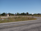
From the junction of Interstate Highways 169 and 10 south of Elk River Minnesota, head north on 169 14.8 miles to County Rd. 9.
Take the County 9 exit, and at the top turn left and head west 6.5 miles to the Blue Hill Trail parking lot on your right.
Coordinates for the hike: 45.4944900,-93.7130400
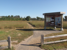
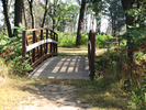
- Parking / Trailhead amenities
- The parking lot is smooth and paved and has room for about 10 cars. There is a clean pit toilet and a map board with brochures and trail guides adjacent to the parking lot.
- Trail observations
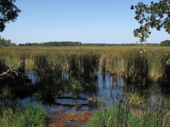
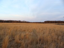
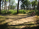
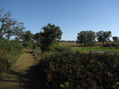
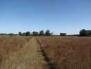
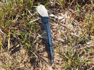
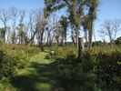
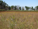
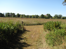
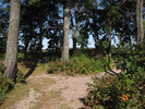
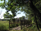
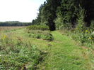
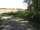
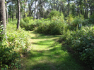
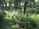
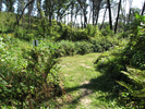
- The trail is a lollipop with a very short shared trail and a largish loop. The trail alternates between scrubby brush and wide open prairie for the first four miles, then the trail enters a pine forest for a ways, then climbs and descends Blue Hill through a dense forest.
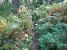
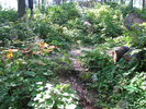
The trail is wide and easy to follow everywhere but on Blue Hill. There it is narrow and overgrown, though it's still easy to follow because the surrounding understory of the forest is too dense to push through off of the trail.
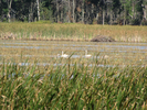
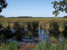
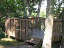
There are two overlooks along the trail - one at Buck Lake, complete with a pair of telescopes that have given me very nice close up images of swans, and another overlook at the top of Blue Hill. Midsummer the view from the hill is largely blocked by the leaves of the trees, but during the late fall, winter, and spring the views are magnificent! - Trail statistics
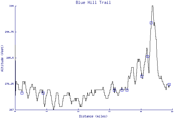
- The trail is 4.90 miles long. The sum of all the uphill climbs is 144 feet.
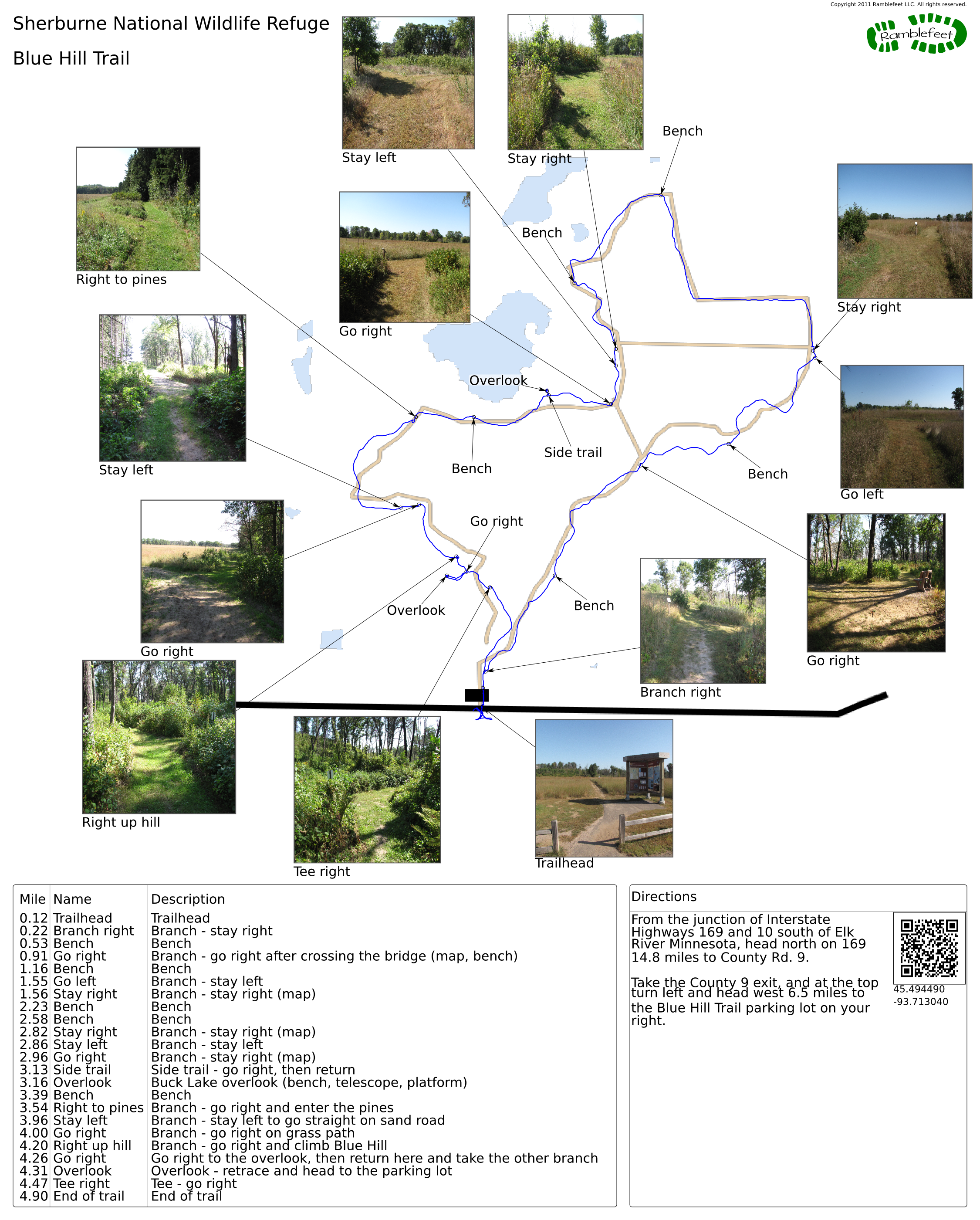
- Trail waypoints
0.12 mi Trailhead Trailhead 0.22 mi Branch right Branch - stay right 0.53 mi Bench Bench 0.91 mi Go right Branch - go right after crossing the bridge (map, bench) 1.16 mi Bench Bench 1.55 mi Go left Branch - stay left 1.56 mi Stay right Branch - stay right (map) 2.23 mi Bench Bench 2.58 mi Bench Bench 2.82 mi Stay right Branch - stay right (map) 2.86 mi Stay left Branch - stay left 2.96 mi Go right Branch - stay right (map) 3.13 mi Side trail Side trail - go right, then return 3.16 mi Overlook Buck Lake overlook (bench, telescope, platform) 3.39 mi Bench Bench 3.54 mi Right to pines Branch - go right and enter the pines 3.96 mi Stay left Branch - stay left to go straight on sand road 4.00 mi Go right Branch - go right on grass path 4.20 mi Right up hill Branch - go right and climb Blue Hill 4.26 mi Go right Go right to the overlook, then return here and take the other branch 4.31 mi Overlook Overlook - retrace and head to the parking lot 4.47 mi Tee right Tee - go right 4.90 mi End of trail End of trail

- Sometimes I ramble...
- Last night as the full moon rose in the afternoon sky I knew I needed something wonderful.
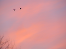
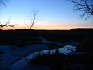
I headed northwest to a wildlife refuge and strapping on my backpack I set off. The wind blew lonely cross the prairie and the bluestem and indian grasses rustled quietly. Off in the distance I could hear the gentle cacophony of geese, duck, and crane settling into a meltwater pond.
The sun set slowly, turning the prairie gold, then pink, then purple. Geese restlessly crossed the sky as I restlessly crossed the prairie. A deer bounded high toward the treeline and paused to look at me for a while.
The trail turned into a stand of pines and in the dappled moonlight I found the trail covered in ice that looked for all the word like polished marble. I skated my way along, watching the moon slide in and out of the tree tops and listening to the whisper of the wind through the boughs.
Slowly the trail climbed and the ice was replaced by snow. At the crest of the hill I could look westward across a prairie flat to the far horizon. The wind was fierce as it broke against the hill and I sat face into it to meditate on the swaying of a birch tree.
The focus wouldn't come but I felt a peacefulness settle into me, and as I sat on the lonely hilltop I pictured lines of connection to the people and places I love. I whispered my thoughts and wishes, talked of my dreams, then lapsed into an easy silence.
The stars slowly whirled and tilted and finally, when the cold became too much, I creaked my way to my car and silently started the long drive home.
Written late March, 2005
- Keywords
- Difficulty: Easy
- Terrain : Flat
- Terrain : Hilly
- Trail surface: Dirt
- Type: Lollipop
- View: Open
- View: Wooded
- County: Sherburne
- State: Minnesota
- Country: United States of America
- Links
- Friends of Sherburne National Wildlife Refuge Blog - this is a cool site!
- Fish and Wildlife Service site
- Refuge map
- Resources
- Printable trail map in PDF format (35 Mb download)
- Printable trail map in PNG format (3 Mb download)
- Waypoints in CSV format
- Waypoints in KML format
- Instructions on using a trail description page
- Instructions on using a trail map printout
- Trails in the surrounding area
- Trailheads for Minnesota North Dakota, South Dakota, and Wisconsin (3 additional trails)
- Trailheads for Minnesota and Wisconsin (4 additional trails)
- Trailheads for Minnesota North Dakota, South Dakota, and Wisconsin (9 additional trails)
- Trailheads for Iowa Minnesota, and Wisconsin (9 additional trails)
Copyright © 2011 RambleFeet LLC. All rights reserved.