Perrot State Park
Brady's Bluff and Perrot Ridge

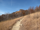
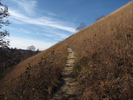
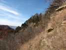
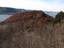
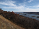
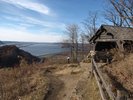
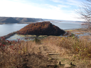
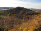
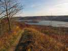
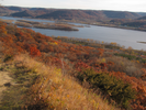
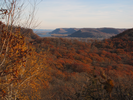
This hike rewards with every step. From the moment you leave the parking lot the view encompasses greater and greater lengths of the Mississippi valley. The view from the top of Brady's bluff is spectacular - barges ferrying cargo up and down the river, bluffs rising to the sky across the river, glints of light sparkling on the blue water far below.
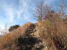
Next is a short traverse of tilted tree ringed meadow, soft filtered light touching the gold and yellow grass, and then an abrupt climb back to the heights of Perrot Ridge where again the world opens up below.
Of all the hikes along the Mississippi, this one may be the best.
- Approach
-
From the junction of 1st and Main streets near the Trempealeau Hotel in Trempealeau Wisconsin, head west along the river 1.9 miles to the trailhead parking lot on your left. Just before you reach the parking lot, you will pass an entrance station where you will need to pay a fee to enter the park.
Coordinates for the hike: 44.0157360,-91.4758580
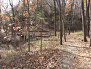
- Parking / Trailhead amenities
- The paved parking lot is level and has room for about 16 cars. There is a clean pit toilet adjacent to the parking lot.
- Trail observations
- The trail starts across the road from the parking lot. Almost immediately the trail branches. Head left to climb Brady's bluff.
At the top, the trail heads down the back of the bluff then traverses a meadow and ascends Perrot Ridge, a narrow exposed sandstone ridge with a different set of incredible views. - Trail statistics
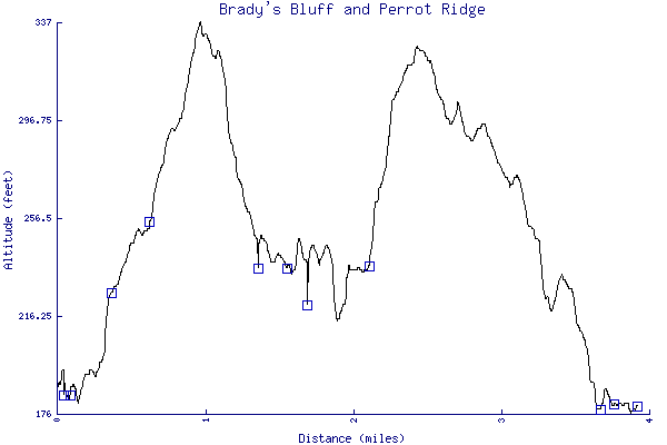
- The trail is 3.91 miles long. The sum of all the uphill climbs is 398 feet.
- Trail waypoints
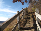
0.00 mi Parking Parking Lot 0.04 mi Trailhead Trailhead 0.08 mi Go left Branch - go left towards Brady's Bluff 0.36 mi Bench 0.61 mi Bench 0.94 mi Right along shelter Branch - go right along the shelter 1.33 mi Stay left Branch - stay left 1.52 mi Go right Branch - go right (map) 1.67 mi Stay left Branch - stay left 1.91 mi Stay left Stay left to go straight (bench, map) 2.09 mi Climb steps Branch - go left up the steps 2.23 mi Bench 2.63 mi Stay left Branch - stay left 3.04 mi Go straight Intersection - go straight (map, bench) 3.68 mi Diagonal right Cross to the trail on the right of the parking lot 3.77 mi Go right Branch - go right along Perrot Ridge Trail 3.91 mi End of trail End of trail

- Keywords
- Difficulty: Easy
- Difficulty: Moderate
- Terrain: Hilly
- Trail surface: Dirt
- Trail surface: Grassy
- Type: Loop
- View: Open
- View: Overlooks
- View: Wooded
- County: Trempealeau
- State: Wisconsin
- Country: United States of America
- Resources
- Printable trail map in PDF format (43 Mb download)
- Printable trail map in PNG format (6 Mb download)
- Waypoints in CSV format
- Waypoints in KML format
- Instructions on using a trail description page
- Instructions on using a trail map printout
- Trails in the surrounding area
- Trailheads for Iowa Minnesota, and Wisconsin (11 additional trails)
- Trailheads for Iowa Michigan, Minnesota, and Wisconsin (5 additional trails)
- Trailheads for Iowa Minnesota, and Wisconsin (7 additional trails)
- Trailheads for Illinois Iowa, Minnesota, and Wisconsin (7 additional trails)
Copyright © 2011 RambleFeet LLC. All rights reserved.