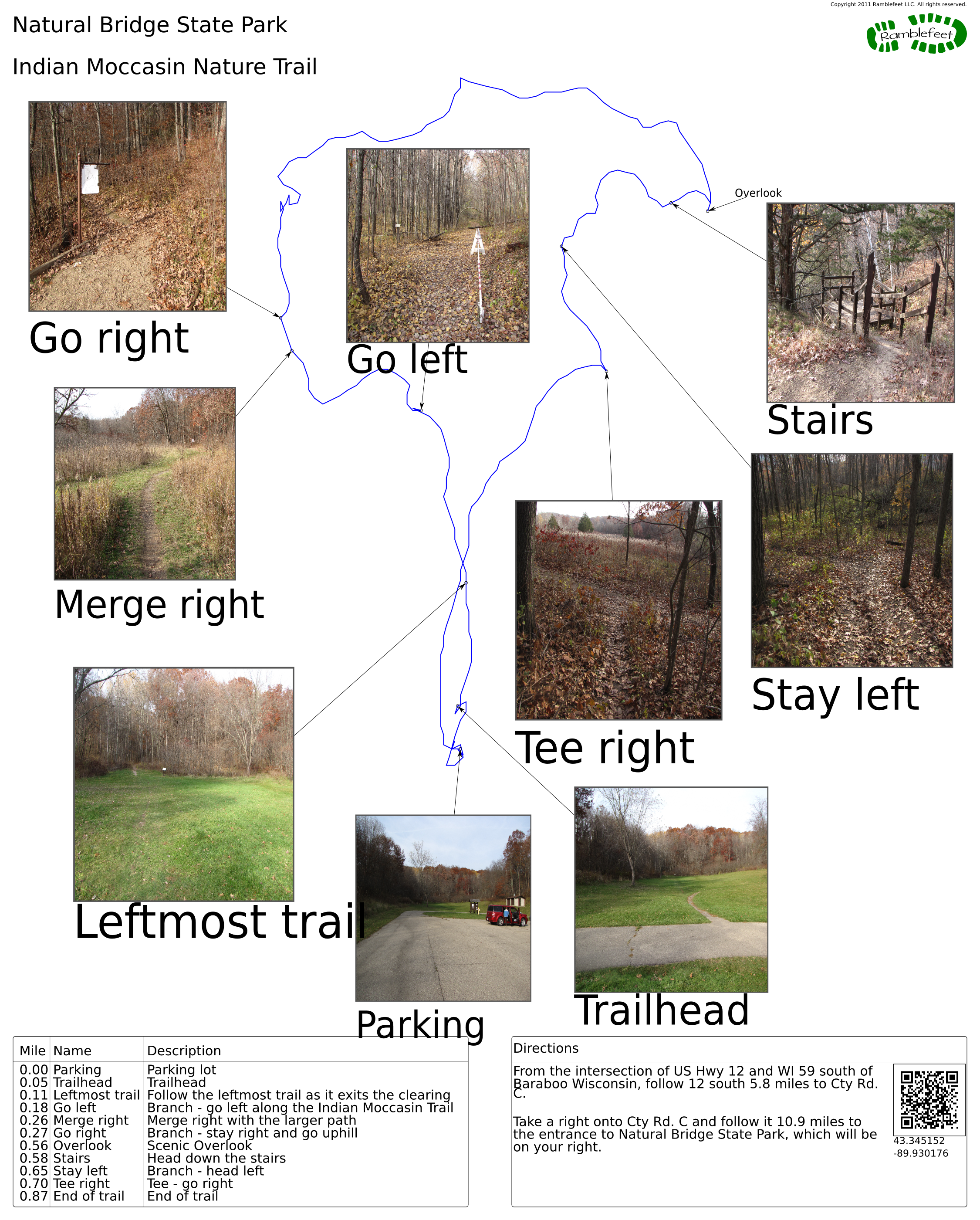
Natural Bridge State Park
Indian Moccasin Nature Trail

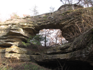
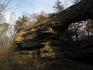
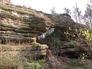
The Indian Moccasin Trail features a visit to Wisconsins largest natural arch, at 35 feet high and with a 25 by 35 foot opening.
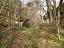
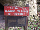
There are signs along the short trail that detail historical uses of the various plants in the area.
All in all, this is an interesting and scenic little hike.
- Approach
-
From the intersection of US Hwy 12 and WI 59 south of Baraboo Wisconsin, follow 12 south 5.8 miles to Cty Rd. C.
Take a right onto Cty Rd. C and follow it 10.9 miles to the entrance to Natural Bridge State Park, which will be on your right.
Coordinates for the hike: 43.3451520,-89.9301760
- Parking / Trailhead amenities
- The paved parking lot is large and level. There is a pit toilet and informational kiosk near the parking lot.
- Trail observations
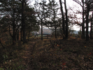
- The trail leaves the parking lot on the side opposite of the car entrance. Initially the trail crosses a wide clearing - go straight across and continue along the trail as it leaves the clearing on the far side.
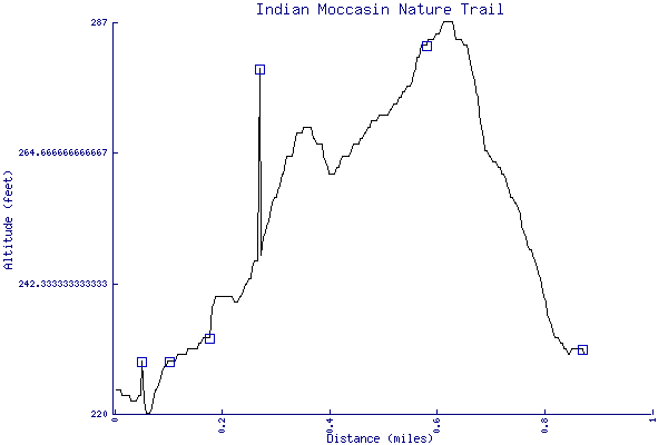
Some parts of the trail are wide and well maintained, other parts are narrow and overgrown. - Trail statistics
- The trail is 0.87 miles long. The sum of all the uphill climbs is 72 feet.
- Trail waypoints
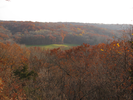
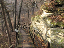
0.00 mi Parking Parking lot 0.05 mi Trailhead Trailhead 0.11 mi Leftmost trail Follow the leftmost trail as it exits the clearing 0.18 mi Go left Branch - go left along the Indian Moccasin Trail 0.26 mi Merge right Merge right with the larger path 0.27 mi Go right Branch - stay right and go uphill 0.56 mi Overlook Scenic Overlook 0.58 mi Stairs Head down the stairs 0.65 mi Stay left Branch - head left 0.70 mi Tee right Tee - go right 0.87 mi End of trail End of trail
- Keywords
- Difficulty: Easy
- Terrain: Hilly
- Trail surface: Dirt
- Trail surface: Grassy
- Type: Loop
- View: Enclosed
- View: Overlooks
- View: Wooded
- County: Richland
- State: Wisconsin
- Country: United States of America
- Links
- DNR site
- Resources
- Printable trail map in PDF format (26 Mb download)
- Printable trail map in PNG format (5 Mb download)
- Waypoints in CSV format
- Waypoints in KML format
- Instructions on using a trail description page
- Instructions on using a trail map printout
- Trails in the surrounding area
- Trailheads for Michigan and Wisconsin (1 additional trail)
- Trailheads for Illinois Iowa, Minnesota, and Wisconsin (9 additional trails)
- Trailheads for Illinois Iowa, and Wisconsin (3 additional trails)
- Trailheads for Illinois Iowa, Minnesota, and Wisconsin (2 additional trails)
- Trailheads for Illinois Iowa, and Wisconsin (2 additional trails)
Copyright © 2011 RambleFeet LLC. All rights reserved.