Matthiessen State Park
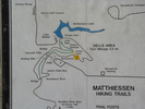
Dells Area Trails

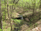
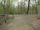
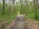
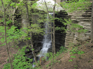
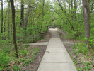
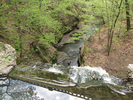
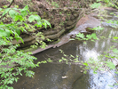
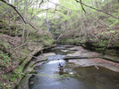
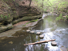
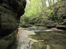
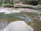
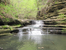
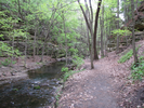
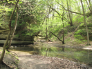
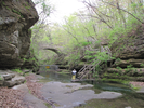
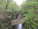
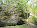
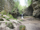
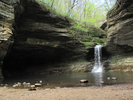
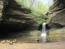
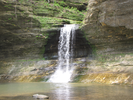
The Dells area of Matthiessen State Park is a joy to hike. There are beautiful waterfalls, tall sandstone bluffs, paths that tunnel through heavily wooded forest, and best of all, a trail that runs right along and often through the river that formed it all.
When I hiked this path with my son the water level was fairly high, and I needed to do a lot of rock hopping and log balancing to make it without getting my tennies wet. My son was much more wisely dressed in sandals and simply went wading.
The tactile joy of the water and finding ways through the ravine made this one of our favorite hikes, and the sheer beauty of the lower Dells will draw me back time and again.
- Approach
-
From the intersection of Interstates 39 and 80 near Peru, Illinois, head east roughly 2 miles to IL-178.
Take IL-178 southbound 5.1 miles to N25th Rd, which is the entrance road to Matthiessen State Park.
Take a right and follow the park road 0.9 miles to the parking lot.
Coordinates for the hike: 41.2959010,-89.0258000
- Parking / Trailhead amenities
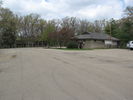
- The parking lot is paved, level, and has lots of room for cars. There is a restroom and some soda vending machines adjacent to the parking lot. There is a sign in the parking lot warning you not to leave valuables in your car.
- Trail observations
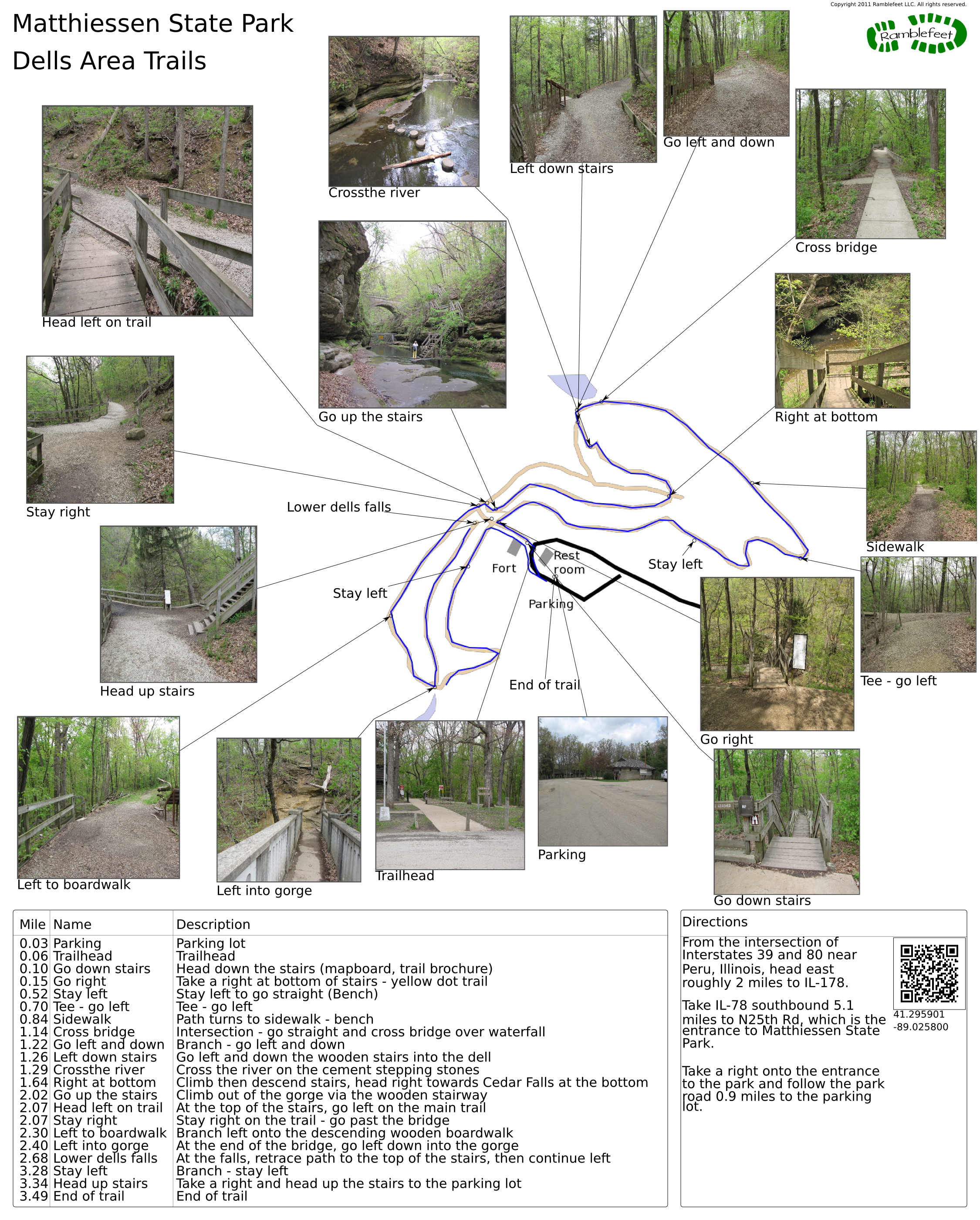
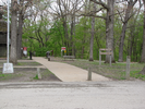
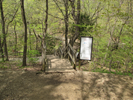
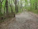
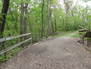
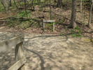
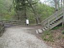
- The trailhead exits the parking lot across the road from the restroom.
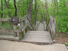
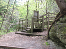
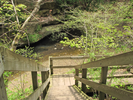
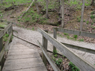
The trail immediately starts descending a flight of wooden stairs. Follow this till you reach an intersection where you can follow a trail to the right. You will follow this trail along an arm of the Dells, then cut back through the woods till you reach a waterfall.
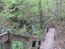
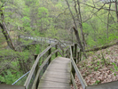
Soon after the waterfall you will descend into the upper dells via another wooden stairway. Traversing the upper dells requires some creative footwork, at least when the water is high, because the path crosses the river a couple of times.
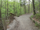
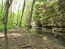
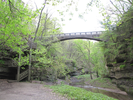
The upper dells extends from the base of a waterfall to the top of a second. You'll leave the upper dells via wooden staircase. Be sure to take in the view of the lower dells from the bridge over the second waterfall.
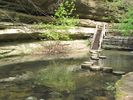
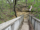
From the second waterfall you will follow the edge of the lower dells until you come to a gradually descending boardwalk which leads to a bridge that crosses the lower dells. At the edge of the bridge is a squared-off spiral cement staircase that gives you access to the lower dells.
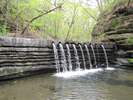
Follow the trail through the dells to the waterfall, then return, climb the spiral stairs, and follow the trail back to your car. - Trail statistics
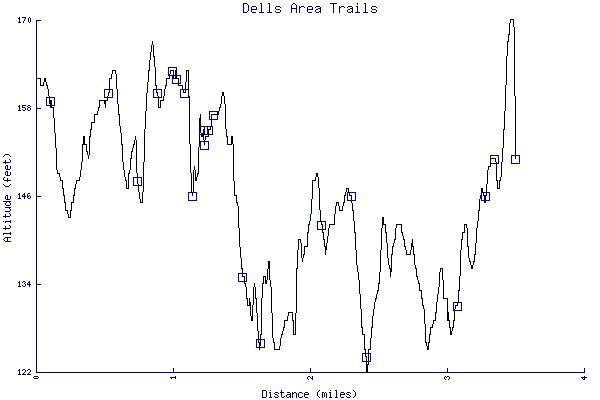
- The trail is 3.49 miles long. The sum of all the uphill climbs is 235 feet.
- Trail waypoints
0.03 mi Parking Parking lot 0.06 mi Trailhead Trailhead 0.10 mi Go down stairs Head down the stairs (mapboard, trail brochure) 0.15 mi Go right Take a right at bottom of stairs - yellow dot trail 0.52 mi Stay left Stay left to go straight (Bench) 0.70 mi Tee - go left Tee - go left 0.84 mi Sidewalk Path turns to sidewalk - bench 1.14 mi Cross bridge Intersection - go straight and cross bridge over waterfall 1.22 mi Go left and down Branch - go left and down 1.26 mi Left down stairs Go left and down the wooden stairs into the dell 1.29 mi Crossthe river Cross the river on the cement stepping stones 1.64 mi Right at bottom Climb then descend stairs, head right towards Cedar Falls at the bottom 2.02 mi Go up the stairs Climb out of the gorge via the wooden stairway 2.07 mi Head left on trail At the top of the stairs, go left on the main trail 2.07 mi Stay right Stay right on the trail - go past the bridge 2.30 mi Left to boardwalk Branch left onto the descending wooden boardwalk 2.40 mi Left into gorge At the end of the bridge, go left down into the gorge 2.68 mi Lower dells falls At the falls, retrace path to the top of the stairs, then continue left 3.28 mi Stay left Branch - stay left 3.34 mi Head up stairs Take a right and head up the stairs to the parking lot 3.49 mi End of trail End of trail

- Keywords
- Difficulty: Easy
- Terrain : Flat
- Terrain : Streambed
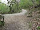
- Trail surface: Dirt
- Trail surface: Gravel
- Trail surface: Paved
- Trail surface: Rock
- Trail surface: Stairs
- Type: Loop
- View: Enclosed
- View: Open
- View: Wooded
- County: Bureau
- State: Illinois
- Country: United States of America
- Resources
- Printable trail map in PDF format (50 Mb download)
- Printable trail map in PNG format (5 Mb download)
- Waypoints in CSV format
- Waypoints in KML format
- Instructions on using a trail description page
- Instructions on using a trail map printout
- Trails in the surrounding area
- Area map for Illinois, Iowa, and Wisconsin (1 additional trail)
- Area map for Illinois, Indiana, Michigan, and Wisconsin (1 additional trail)
- Area map for Illinois, Iowa, and Missouri (No additional trails)
- Area map for Illinois, Indiana, and Michigan (No additional trails)
Copyright © 2011 RambleFeet LLC. All rights reserved.