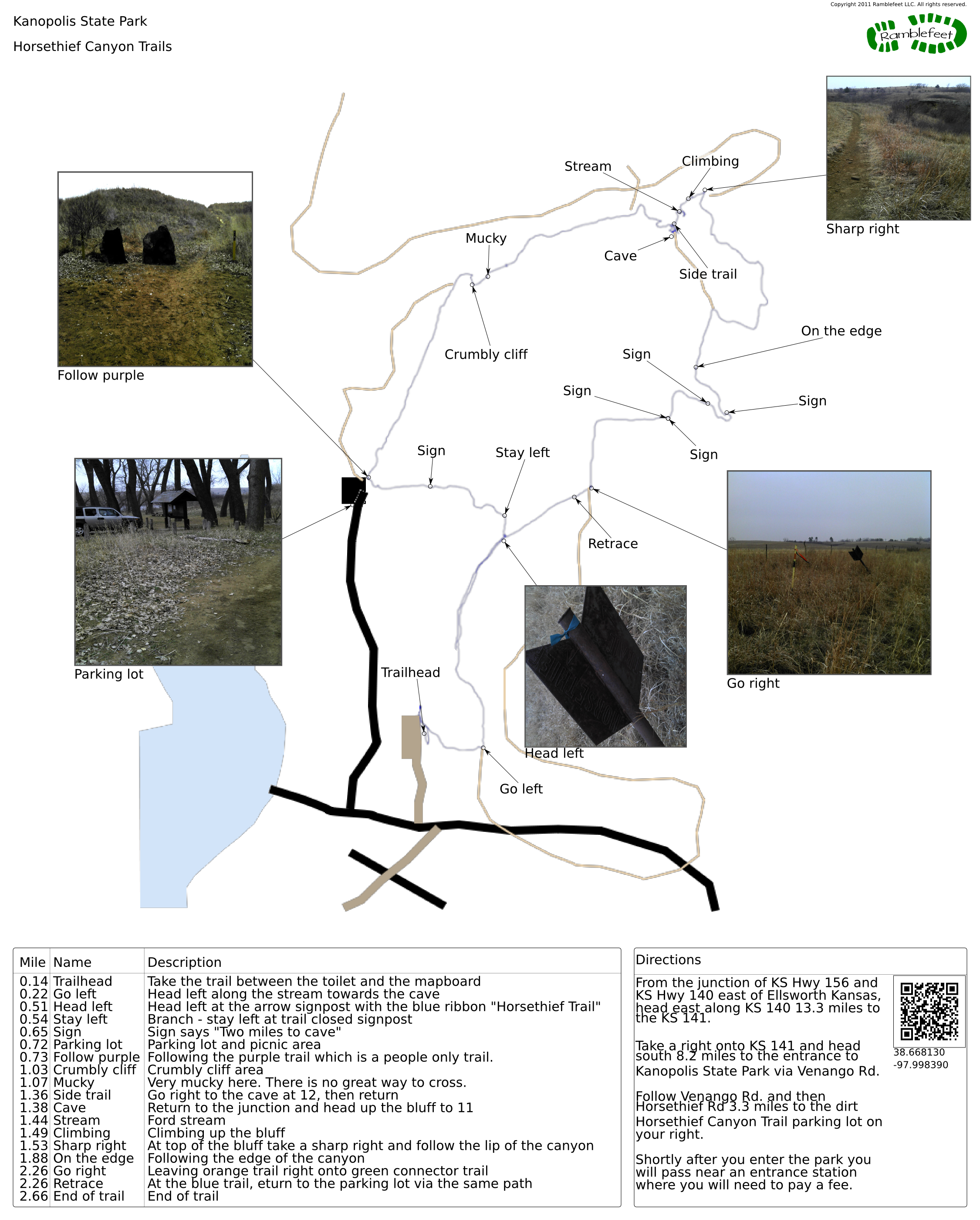
Kanopolis State Park
Horsethief Canyon Trails
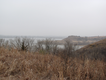
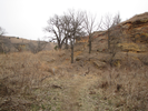
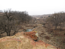
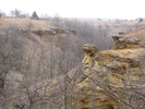
Long views of sandstone bluffs, deep canyons cutting through beautiful grasslands, and a sparkling lake tucked in the heart of it all.
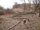
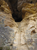
The Horsethief Canyon area of Kanopolis State Park is a pleasure to explore - the trails cross the grasslands and dip into the canyons. Side trails explore caves and the small streams that have cut the canyons.
My son and I have only hiked this area once, and both of us have a strong desire to go back and explore it again.
- Approach
-
From the junction of KS Hwy 156 and KS Hwy 140 east of Ellsworth Kansas, head east along KS 140 13.3 miles to the KS 141.
Take a right onto KS 141 and head south 8.2 miles to the entrance to Kanopolis State Park via Venango Rd.
Follow Venango Rd. and then Horsethief Rd 3.3 miles to the dirt Horsethief Canyon Trail parking lot on your right.
Shortly after you enter the park you will pass near an entrance station where you will need to pay a fee.
Coordinates for the hike: 38.6681300,-97.9983900
- Parking / Trailhead amenities
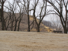
- The dirt parking lot is large and level. There is a pit toilet and mapboard adjacent to the parking lot, as well as picnic facilities and access to the reservoir.
- Trail observations
- The trail exits the parking lot between the toilet and the mapboard. The trail surface is occasionally muddy and in some places quite slippery.
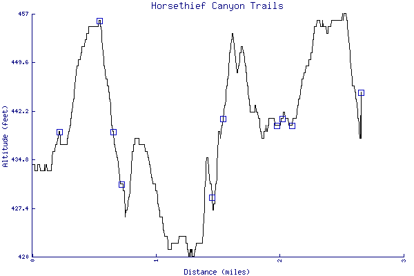
- Trail statistics
- The trail is 2.66 miles long. The sum of all the uphill climbs is 115 feet.
- Trail waypoints
0.14 mi Trailhead Take the trail between the toilet and the mapboard 0.22 mi Go left Head left along the stream towards the cave 0.51 mi Head left Head left at the arrow signpost with the blue ribbon "Horsethief Trail" 0.54 mi Stay left Branch - stay left at trail closed signpost 0.65 mi Sign Sign says "Two miles to cave" 0.72 mi Parking lot Parking lot and picnic area 0.73 mi Follow purple Following the purple trail which is a people only trail. 1.03 mi Crumbly cliff Crumbly cliff area 1.07 mi Mucky Very mucky here. There is no great way to cross. 1.36 mi Side trail Go right to the cave at 12, then return 1.38 mi Cave Return to the junction and head up the bluff to 11 1.44 mi Stream Ford stream 1.49 mi Climbing Climbing up the bluff 1.53 mi Sharp right At top of the bluff take a sharp right and follow the lip of the canyon 1.88 mi On the edge Following the edge of the canyon 1.96 mi Sign 2.01 mi Sign 2.09 mi Sign 2.09 mi Sign 2.26 mi Go right Leaving orange trail right onto green connector trail 2.26 mi Retrace At the blue trail, return to the parking lot via the same path 2.66 mi End of trail End of trail
- Keywords
- Difficulty: Easy
- Difficulty: Moderate
- Feature: Cave
- Feature: Rock climbing
- Terrain: Canyon
- Terrain: Hilly
- Trail surface: Dirt
- Trail surface: Grassy
- Type: Lollipop
- View: Open
- View: Overlooks
- County: Ellsworth County
- State: Kansas
- Country: United States of America
- Resources
- Printable trail map in PDF format (3 Mb download)
- Printable trail map in PNG format (2 Mb download)
- Waypoints in CSV format
- Waypoints in KML format
- Instructions on using a trail description page
- Instructions on using a trail map printout
- Trails in the surrounding area
- Trailheads for Kansas and Nebraska (1 additional trail)
- Trailheads for Iowa Kansas, Missouri, and Nebraska (2 additional trails)
- Trailheads for Kansas and Oklahoma (1 additional trail)
- Trailheads for Kansas Missouri, and Oklahoma (2 additional trails)
Copyright © 2011 RambleFeet LLC. All rights reserved.