Jeffers Petroglyphs
Loop Trail
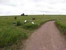
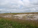
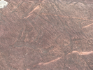
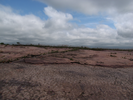
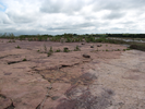
Jeffers Petroglyphs is a place of power. The first time I walked here was in the early morning, a cold wind blowing across the prairie on a leaden sky day. The rustle of the grass seemed distance as I first set foot on the stone, staring long at each carving, slowly becoming one with the prairie and the stone.
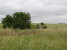
This is a place worth visiting many times. Light makes all the difference - morning and afternoon light show the carvings best, but other light shows other things.
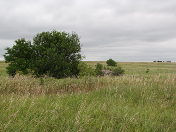
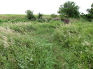
The walk through the prairie after viewing the petroglyphs is quiet and contemplative, a good place for newfound feelings to find their place.
- Approach
-
From the junction of MN-19 and Interstate Hwy 71 in Redwood Falls, Minnesota, head south along I71 for 30.2 miles to Cty. Hwy 10.
At Cty Hwy 10, turn left and head east 3.0 miles to 510th Ave/Cty Rd 2.
Turn right onto Cty Rd. 2 and head south 1.2 miles to the entrance to Jeffers Petroglyphs.
Coordinates for the hike: 44.0909020,-95.0586670
- Parking / Trailhead amenities
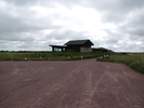
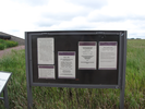
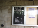
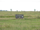
- Park in the gravel parking lot - there is plenty of room. You will need to enter the visitors center to pay an entrance fee - rates are posted along the short path that leads to the visitor center. The visitor center has clean restrooms and some interesting exhibits, along with gifts and merchandise for sale.
- Trail observations
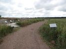
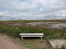
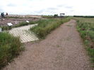
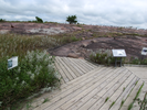
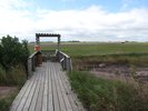
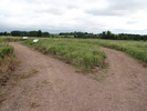
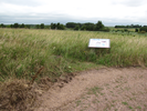
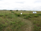
- The trailhead starts at the exit from the visitors center - the gravel trail to the petroglyphs is wide and smooth. There are benches and signs along the trail. When you get to the petroglyphs, be sure to walk along all the boardwalks - when you are walking on rock, be sure to stay inside the rope walkway!
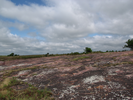
Beyond the petroglyphs, a mowed trail leaves from the end of a turnaround on the gravel pathway. Take this trail to return to the visitors center. - Trail statistics
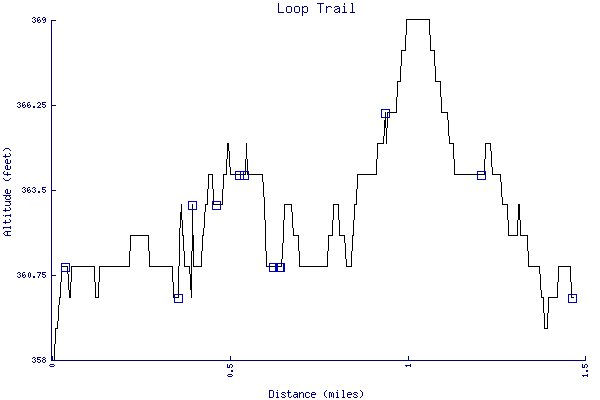
- The trail is 1.47 miles long. The sum of all the uphill climbs is 30 feet.
- Trail waypoints
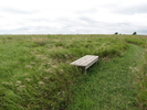
0.04 mi Parking Parking lot and visitor center 0.17 mi Go right Branch - stay right 0.33 mi Bench Bench 0.38 mi 1st Boardwalk First boardwalk 0.42 mi Keep left Keep going left 0.49 mi Water Water break on a platform 0.52 mi Rope Path Rope path 0.56 mi Go left Branch - go left 0.66 mi Stay left Branch - stay left 0.67 mi Mowed trail Branch - go left onto mowed trail 0.91 mi Bench Bench 0.95 mi Go straight Intersection - go straight across 0.98 mi Go straight Intersection - go straight 1.22 mi Sidetrail Go right on side trail, then return and go left 1.41 mi Right to the center Branch - go right to the visitors center 1.47 mi Trail End Trail end

- Keywords
- Difficulty: Easy
- Terrain : Flat
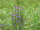
- Trail surface: Grassy
- Trail surface: Gravel
- Trail surface: Rock
- Type: Loop
- View: Open
- County: Cottonwood
- State: Minnesota
- Country: United States of America
- Resources
- Printable trail map in PDF format (59 Mb download)
- Printable trail map in PNG format (4 Mb download)
- Waypoints in CSV format
- Waypoints in KML format
- Instructions on using a trail description page
- Instructions on using a trail map printout
- Trails in the surrounding area
- Area map for Minnesota, North Dakota, and South Dakota (3 additional trails)
- Area map for Minnesota, North Dakota, South Dakota, and Wisconsin (6 additional trails)
- Area map for Iowa, Minnesota, Nebraska, and South Dakota (3 additional trails)
- Area map for Iowa, Minnesota, Nebraska, and South Dakota (5 additional trails)
Copyright © 2011 RambleFeet LLC. All rights reserved.