Hidden Falls Park
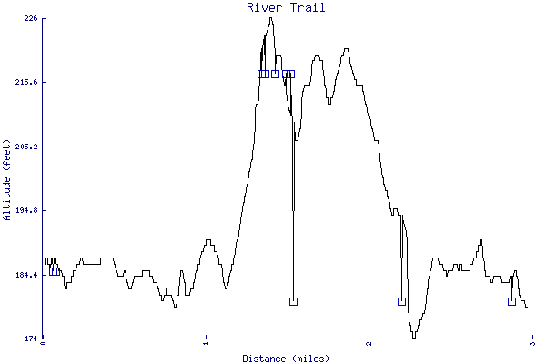
River Trail
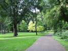
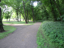
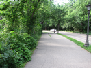
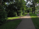
Hidden Falls regional park occupies a mile and a half strip of land between tall bluffs and the Mississippi. A paved trail follows the river for much of the parks length, though at the north end it leaves the bottomlands to climb the bluff along side the north entrance road.
The trail has nice views of the river and the bluffs on the far side. This hike has a few fun surprises, and is worth doing when you have a little free time and don't want to leave the city.
- Approach
-
From the junction of 494 and MN Hwy 5 near the Minneapolis/St. Paul international airport, drive north on Hwy 5 2.7 miles to the Shepard Rd/River Rd. exit just after crossing over the Mississippi River.
Keep turning right on to Gannon Road for a tiny distance, then turn right again onto S. Mississippi Blvd (also Shepard Rd.)
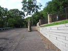
Follow Shepard Rd for 0.2 miles to the entrance to Hidden Falls Park (south gate) on your left.
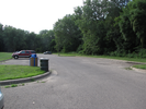
Take a sharp left into the park and immediately start descending. You'll cross under Hwy 5, then immediately switch back and cross under it again. Keep following the park road till you reach the parking lot about 0.6 miles into the park.
Coordinates for the hike: 44.8967200,-93.1853900
- Parking / Trailhead amenities
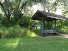
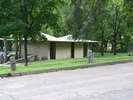
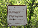
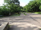
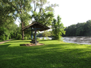
- The parking lot has space for about 50 cars. It's level and paved - there are signs in the park advising that you not leave any valuables in your car. There are no facilities on this end of the park, though there is a restroom about a mile along the trail.
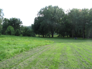
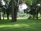
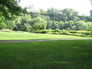
There are several picnic tables and a nice big meadow adjacent to the parking lot. - Trail observations
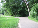
- To get to the paved trail, head toward the river across the large meadow. The paved trail parallels the river - when you reach it, turn right and follow it.
This trail is an out and back, so you will be returning the same way - keep track of where you have parked your car!
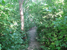
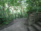
There are a couple of moderate climbs and descents on this trail, one of them involving steps. There is also a short section at the end where the trail is on dirt and gravel and it is a bit irregular. If this seems like it's too much, you can turn around at any point and return the way you came. - Trail statistics
- The trail is 2.97 miles long. The sum of all the uphill climbs is 129 feet.
- Trail waypoints
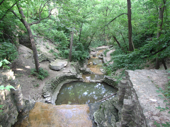
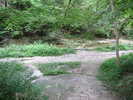
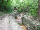
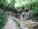
0.07 mi Parking South Gate Parking lot 0.09 mi Meadow cross Cross the meadow towards the river 0.12 mi Approach Approaching the paved trail 0.15 mi Tee - go right Take a right on to the trail 0.36 mi Viewing bench Bench with a view 0.83 mi Keep right Keep to the right 0.90 mi Strolling Strolling along 0.98 mi Stay right Stay right 1.14 mi Hill Climbing hill - restroom on left 1.22 mi Stairs ahead Climb the stairs 1.25 mi Cross road Cross the entrance road 1.34 mi Stay left Stay to the left 1.35 mi Overlook Overlook for the falls 1.41 mi Take 2nd left Take the 2nd left and go down the stairs 1.42 mi Head down Head towards the railing and down the stairs 1.47 mi Go left Go left on the dirt and gravel trail 1.51 mi Small falls Small falls 1.51 mi Turnaround point Hidden falls 2.18 mi River watch Nice place to sit and watch the river flow 2.88 mi End of trail End of trail


- Keywords
- Difficulty: Easy
- Terrain : Hilly
- Trail surface: Dirt
- Trail surface: Grassy
- Trail surface: Gravel
- Trail surface: Paved
- Type: Out-and-back
- View: Enclosed
- View: Open
- View: Shoreline
- View: Wooded
- County: Ramsey
- State: Minnesota
- Country: United States of America
- Resources
- Printable trail map in PDF format (28 Mb download)
- Printable trail map in PNG format (3 Mb download)
- Waypoints in CSV format
- Waypoints in KML format
- Instructions on using a trail description page
- Instructions on using a trail map printout
- Trails in the surrounding area
- Area map for Minnesota and Wisconsin (1 additional trail)
- Area map for Minnesota, North Dakota, South Dakota, and Wisconsin (6 additional trails)
- Area map for Iowa, Minnesota, and Wisconsin (6 additional trails)
- Area map for Iowa, Minnesota, Nebraska, and South Dakota (5 additional trails)
- Area map for Iowa, Minnesota, and Wisconsin (4 additional trails)
Copyright © 2011 RambleFeet LLC. All rights reserved.