Dinosaur National Monument
Harpers Corner

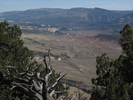
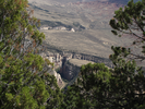
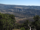
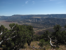
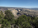
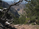
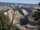
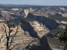
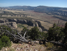
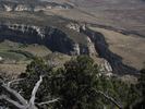
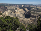
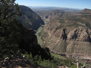
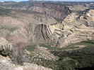
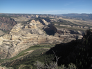
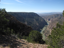
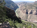
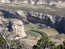
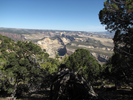
Harpers Corner is a long drive from anywhere, and when you finally arrive you might think you've seen all you could see on the drive in. You would be wrong - the views as you walk are astounding.
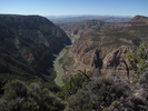
Different views are seen as you move along - a road deep in a canyon far below, tall cliffs foreshortened to small bumps, rushing rapids made tiny by the vast distance but still audible in the palpable silence.
- Approach
-
From the junction of US-40 and US-191 in Vernal Utah, follow US-40 east 35.2 miles to the entrance road to Dinosaur National Monument.
Take a left onto the entrance road and follow it north 31.5 miles to the end, where there will be a parking lot for the Harpers Corner Trailhead. There are numerous overlooks along the way, and I would highly recommend stopping at each and taking a look.
Be sure to stock up on water before leaving US-40.
Coordinates for the hike: 40.5241700,-109.0205800
- Parking / Trailhead amenities
- The parking lot is paved and large. There is a pit toilet adjacent to the lot, but no other facilities.
- Trail observations
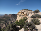
- Harpers corner is a moderately easy out and back trail with stunning vistas of the surrounding canyon country. The views are incredible, and there is a lot to look at. I recommend bringing binoculars and giving yourself plenty of time for site-seeing.
I've hiked this trail in winter, spring, and fall, and I've felt overheated every time. Bring plenty of water on this hike! - Trail statistics
- The trail is 2.42 miles long. The sum of all the uphill climbs is 113 feet.
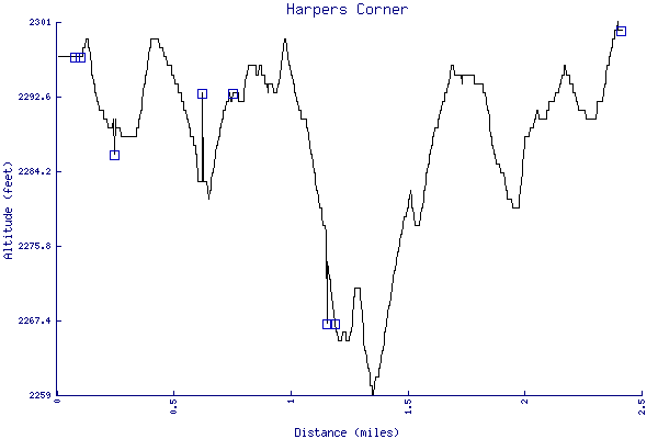
- Trail waypoints
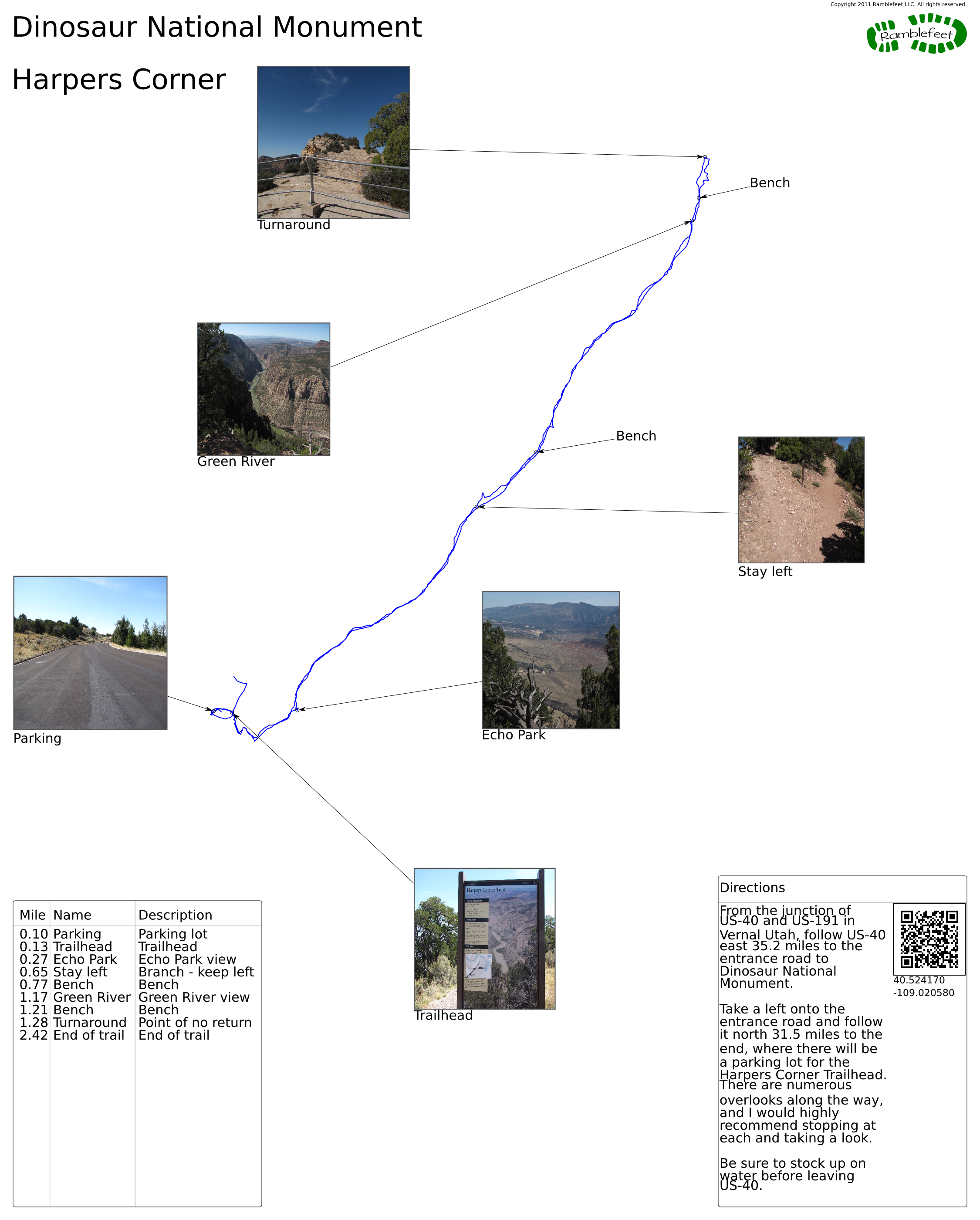
0.10 mi Parking Parking lot 0.13 mi Trailhead Trailhead 0.27 mi Echo Park Echo Park view 0.65 mi Stay left Branch - keep left 0.77 mi Bench Bench 1.17 mi Green River Green River view 1.21 mi Bench Bench 1.28 mi Turnaround Point of no return 2.42 mi End of trail End of trail
- Keywords
- Difficulty: Easy
- Difficulty: Moderate
- Terrain: Mountainous
- Trail surface: Dirt
- Type: Out-and-back
- View: Open
- View: Overlooks
- County: Moffat County
- State: Colorado
- Country: United States of America
- Resources
- Printable trail map in PDF format (11 Mb download)
- Printable trail map in PNG format (1 Mb download)
- Waypoints in CSV format
- Waypoints in KML format
- Instructions on using a trail description page
- Instructions on using a trail map printout
- Trails in the surrounding area
- Trailheads for Colorado Idaho, Utah, and Wyoming (No additional trails)
- Trailheads for Colorado Utah, and Wyoming (-1 additional trail)
- Trailheads for Colorado Utah, and Wyoming (No additional trails)
- Trailheads for Colorado Utah, and Wyoming (No additional trails)
Copyright © 2011 RambleFeet LLC. All rights reserved.