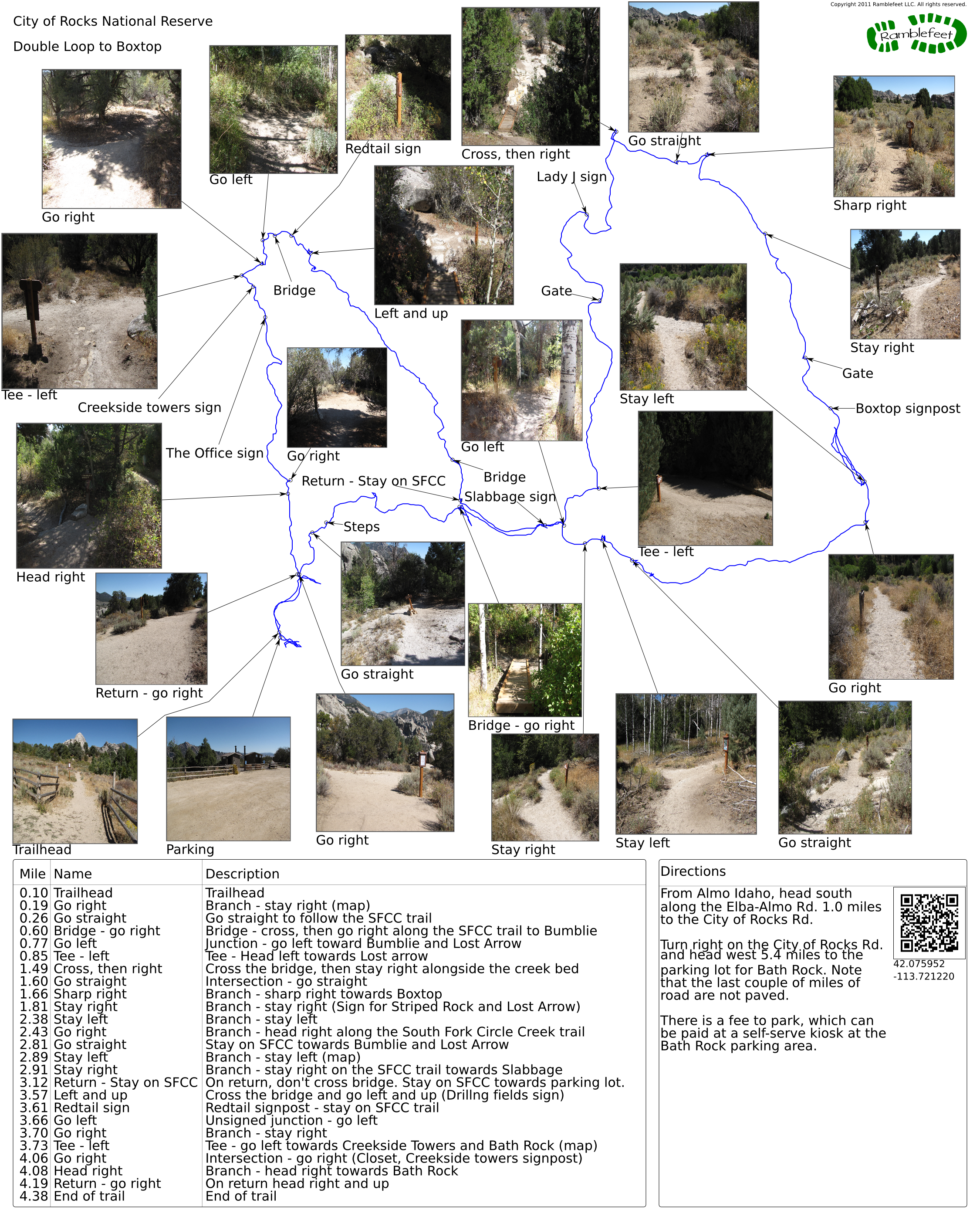
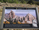
City of Rocks National Reserve
Double Loop to Boxtop
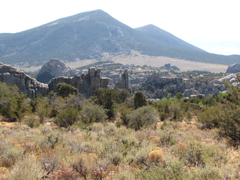
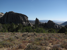
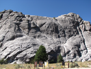
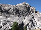
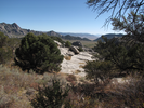
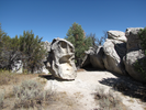
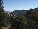
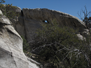
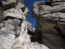
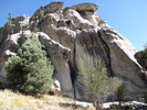
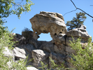
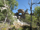
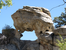
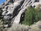
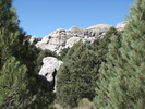
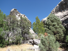
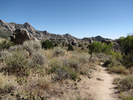
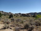
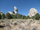
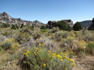
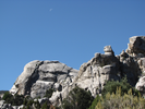
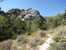
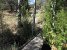
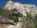
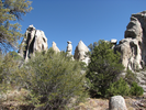
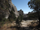
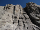
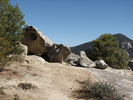
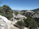
City of Rocks in an amazing place to go for a hike. Frequently as you walk you can see miles away but not see the next 30 feet, as the trail often winds through tight rock formations and short sections of heavy foliage.
The day I explored City of Rocks, the air was blue sky cool and the trees were hinting at fall colors to come. There were moments of heat in the more dense rock and tree sections, and then the trail would lead to an overlook and I would revel in the cooling breeze.
This is one of my favorite hikes - it's novel, it's quiet, and it's truly beautiful!
- Approach
-
From Almo Idaho, head south along the Elba-Almo Rd. 1.0 miles to the City of Rocks Rd.
Turn right on the City of Rocks Rd. and head west 5.4 miles to the parking lot for Bath Rock. Note that the last couple of miles of road are not paved.
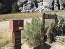
There is a fee to park, which can be paid at a self-serve kiosk at the Bath Rock parking area.
Coordinates for the hike: 42.0759520,-113.7212200
- Parking / Trailhead amenities
- The dirt parking lot is large and level. There are clean pit toilets and a water faucet in the parking lot. Adjacent to the parking lot are a campground and several informational kiosks.
- Trail observations
- The trail leaves from the left side of the parking lot as you are facing away from Bath Rock.
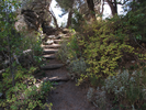
The trail is mostly either ascending or descending. The trail surface is mostly dirt with a few rock crossings - though the trail is only single file, it's easy to walk on and is in good shape.
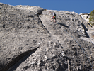
The trail markings are a little hard to fathom till you realize that most times the names are referring to a spot to climb and not to a trail. Once you realize that, things start to make sense - sort of...
Luckily there are not a whole lot of volunteer trails that go very far, so trail finding shouldn't be too big an issue.
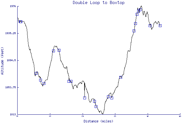
Bring lots of water - it's dry and hot in the sheltered and lower sections of trail, and there is a lot of uphill climbing. - Trail statistics
- The trail is 4.38 miles long. The sum of all the uphill climbs is 335 feet.
- Trail waypoints
0.09 mi Parking Parking 0.10 mi Trailhead Trailhead 0.19 mi Go right Branch - stay right (map) 0.26 mi Go straight Go straight to follow the SFCC trail 0.29 mi Steps Trail heading down steps 0.60 mi Bridge - go right Bridge - cross, then go right along the SFCC trail to Bumblie 0.74 mi Slabbage sign Side trail to Slabbage 0.77 mi Go left Junction - go left toward Bumblie and Lost Arrow 0.85 mi Tee - left Tee - Head left towards Lost arrow 1.13 mi Gate Go through the gate 1.29 mi Lady J sign Side trail to Lady J 1.49 mi Cross, then right Cross the bridge, then stay right alongside the creek bed 1.60 mi Go straight Intersection - go straight 1.66 mi Sharp right Branch - sharp right towards Boxtop 1.81 mi Stay right Branch - stay right (Sign for Striped Rock and Lost Arrow) 2.00 mi Gate Go through the gate 2.08 mi Boxtop signpost Sidetrail to Boxtop 2.38 mi Stay left Branch - stay left 2.43 mi Go right Branch - head right along the South Fork Circle Creek trail 2.81 mi Go straight Stay on SFCC towards Bumblie and Lost Arrow 2.89 mi Stay left Branch - stay left (map) 2.91 mi Stay right Branch - stay right on the SFCC trail towards Slabbage 3.12 mi Return - Stay on SFCC On return, don't cross bridge. Stay on SFCC towards parking lot. 3.18 mi Bridge Bridge 3.57 mi Left and up Cross the bridge and go left and up (Drillng fields sign) 3.61 mi Redtail sign Redtail signpost - stay on SFCC trail 3.64 mi Bridge Bridge 3.66 mi Go left Unsigned junction - go left 3.70 mi Go right Branch - stay right 3.73 mi Tee - left Tee - go left towards Creekside Towers and Bath Rock (map) 3.75 mi Creekside towers sign Creekside Towers sign 3.80 mi The Office sign The Office, Creekside towers sign 4.06 mi Go right Intersection - go right (Closet, Creekside towers signpost) 4.08 mi Head right Branch - head right towards Bath Rock 4.19 mi Return - go right On return head right and up 4.38 mi End of trail End of trail

- Keywords
- Difficulty: Moderate
- Terrain: Mountainous
- Trail surface: Dirt
- Trail surface: Rock
- Type: Multiple-Loop
- View: Enclosed
- View: Open
- View: Overlooks
- View: Wooded
- County: Cassia
- State: Idaho
- Country: United States of America
- Links
- Incredible wildlife photos
- National Park service web site
- PDF map of the trails - you should carry a copy of this when you hike the trail.
- Resources
- Printable trail map in PDF format (65 Mb download)
- Printable trail map in PNG format (5 Mb download)
- Waypoints in CSV format
- Waypoints in KML format
- Instructions on using a trail description page
- Instructions on using a trail map printout
- Trails in the surrounding area
- Trailheads for Idaho Nevada, Oregon, and Utah (1 additional trail)
- Trailheads for Idaho Nevada, and Utah (1 additional trail)
- Trailheads for Idaho Nevada, and Utah (No additional trails)
Copyright © 2011 RambleFeet LLC. All rights reserved.