Carley State Park
River Crossing Trail
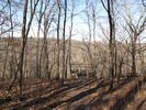
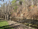
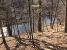
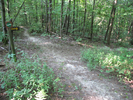
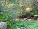
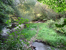
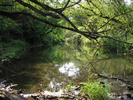
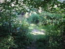
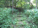
There is an awful lot packed into this short trail - strolling through stands of tall white pine, scrambling across rivers, far views above, and peaceful views walking along the edge of a quiet river.
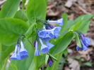
In the spring and summer this is a wonderland of wildflowers and in the fall the oak and maple are brilliant in the low afternoon sun. Come November and suddenly the views open up and you can see the winding river below as you walk high above.
- Approach
-
From the junction of MN Hwy 247 and Cty Rd 4 in Plainview, Minnesota, head south on Cty Rd. 4 (also known as MN Hwy 42) for 0.5 miles till Cty Rd. 4 breaks away from Hwy 42.
Follow Cty Rd 4 3.3 miles south to the entrance to Carley State Park on your right.
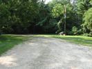
Enter Carley State Park, following the dirt road 0.2 miles to where the road splits. Pay the parking fee at the fee station here.
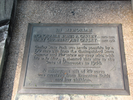
Proceed a very short distance to where the road splits a second time, and take a right into the parking lot. There will be a flagpole and a plaque about the park at the parking lot.
Coordinates for the hike: 44.1115880,-92.1739410
- Parking / Trailhead amenities
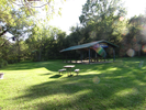
- The parking lot is dirt, level, and has room only for a small number of cars. There are no facilities near the parking lot. There is a pit toilet about 2 miles along the trail in the picnic area.
- Trail observations
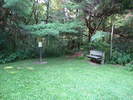
- The trailhead exits the parking lot between the bench and the trailmap. The trail quickly branches right, and from there makes a big winding loop that ends up back at the branch.
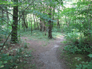
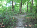
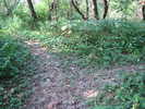
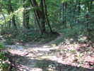
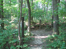
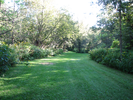
The dirt trail is usually very narrow - it can get slippery, though the trail is never near any cliffs so there is no danger of anything more than a simple fall.
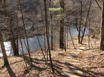
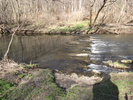
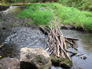
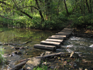
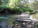
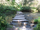
The trail also crosses the river twice - this can be a challenge because the river level varies a lot, and the cement blocks used to cross the river are often under water or shifted out of alignment.
It's fairly likely that in the spring the river will be uncrossable due to high water. - Trail statistics
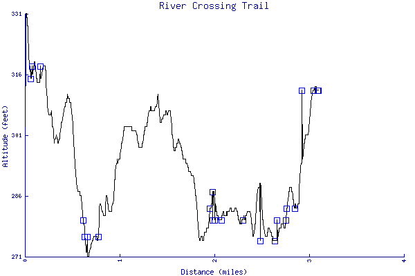
- The trail is 3.09 miles long. The sum of all the uphill climbs is 188 feet.
- Trail waypoints
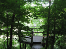
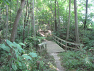
0.05 mi Parking Parking lot 0.06 mi Stay right Branch - stay right 0.07 mi Trailhead Trailhead 0.21 mi Go right Branch - stay right 0.26 mi Side trail Side trail - go left then return and continue straight 0.32 mi Overlook Overlook 0.59 mi Bench Bench 0.62 mi Crossing River crossing 0.64 mi Stay left Branch - stay left 0.78 mi Stay left (bench) Branch - stay left (Bench) 0.85 mi Go right Branch - stay right 1.27 mi Tee - left Tee - go left (trail map) 1.38 mi Wood bridge Wood bridge 1.94 mi Cement blocks River crossing 1.96 mi Tee left Tee - go left 2.06 mi Tee left again Tee - go left 2.29 mi Bench Bench 2.45 mi Bench Bench 2.48 mi Picnic area Picnic area - stay left along the river 2.57 mi Along the river Stay left along the river 2.63 mi Go straight Intersection - go straight. Don't cross the river! 2.75 mi Stairs Stairs 2.75 mi Bench Bench 2.84 mi Go straight Intersection - stay left to go straight 2.89 mi Stay right Intersection - stay right to go straight 3.04 mi Right to the lot Branch - stay right to head to the parking lot 3.08 mi End of trail Trail end

- Sometimes I ramble...
- About an hours drive south there is a park that is always empty and I knew I would be able to roam for miles in solitude. Intellectually I knew it would be a good choice for my full moon hike, but unfortunately as I was driving to the park last night I felt a tugging toward a more remote ravine. I resisted the urge, reasoning that exploring a deep, little known ravine in the dark with large amounts of snow on the ground was verging on insane.
I was about a mile from the turn to the park when my cell phone rang. My little boy was calling to laugh with me. I happily giggled with him until he abruptly said "Beep!", beeped a phone button, and hung up.
I laughed a bit longer then realized I had missed my turn and was heading for the ravine. I reflected on how I'd found it - when my little boy was an infant he would nap most of the time and I would take him in the car for long drives while I explored the countryside. When he would wake up I would take him for a walk wherever we happened to be.
He roused one day as we were nearing Carley State Park. I carried my son in amongst the trees and did a little exploring and found an overlook into the ravine. I looked down into it and it seemed too steep to descend with my son, so I put off my explorations for another day.
Back in the present the sun set over the crazily carved snow, dipping below the horizon with just the faintest touch of red. I knew the night would be clear and cold and when I arrived at Carley Park it was full dark. I walked the edge of the roadside snowbank until I could see the depression of some old footprints, then stepped into the snow.
In the woods the trail was invisible but I could sense a different texture with my boots where someone had walked before. The footing was masked and I felt my way with poles and the touch of my feet. The hidden footprints headed towards the ravine and then curved before reaching the edge, thankfully far enough back that I didn't need to worry.
The footsteps turned downwards and followed a break in the bluff for a steep descent. The snow had drifted deeper in places and at times I slid in a small avalanche of powder. At the bottom the trail led to the river and I saw to my dismay that there was a mishmash of flood torn trees square in the middle of the only way to cross.
I had serious misgivings but didn't want to end my hike so quickly so I carefully started climbing and threading my way through the ice coated trees. The snow hid everything and underneath me I could hear the water rushing. As I slowly worked my way through the tangle my fear grew that I would slip and snap a leg or drop into the river and be pinned underwater by branches.
At last I reached the final tree of the tangle and I used my pole to probe the unseen ground. It felt firm and I stepped off. With a deep breath I looked up and was astounded at how bright the stars were. Orion was decorated with millions of stars. The Milky Way sprayed itself across the center of the sky and the Big Dipper hung vertical. The seven stars of the Pleides were easily visible amidst the backdrop of a myriad of others. I lost myself in wonder for a long while till the hoot of an owl brought me back.
The trail followed a bottomland for a ways then ascended the cliff - my cold congested chest made plowing through the snow doubly hard and I felt relieved when I made it to the top. The valley spread out below me, dimly seen cliffs crowned by frozen waves of snow, the trees tracing black lines against the star filled sky. The only sound was the rustle of branches in the light breeze.
The path dropped, then curved to follow the river between the cliffs, and I was starting to struggle with exhaustion. The snow was smooth as it filled depressions and hid fallen trees, and each step sucked a little more energy. Ahead the rivers path flowed directly against the cliff and I was forced to pick my way across the water on ice coated boulders.
I ascended the cliff through deep unconsolidated snow, moving slowly and deliberately. The moon rose up over the trees and I was finally able to see my footing and I picked up speed for the last mile of my hike.
I entered a small moonlit filled meadow and spotted my car at the far end. The meadow had blown clear and I knew it would be a short easy walk to my car. I thought about the drive home in my fever sweat soaked clothes, thought about the fresh shirt and jeans back in my car.
I looked round the meadow, entranced by the pearl glow, then stripped off all my clothes. My body steamed in the well below freezing air and I stood for an endless moment of joy clothed only in moonlight.
I sang praises to my car heater on the way home.
- Keywords
- Difficulty: Moderate
- Terrain : Bluff
- Trail surface: Dirt
- Trail surface: Grassy
- Type: Loop
- View: Shoreline
- View: Wooded
- County: Wabasha
- State: Minnesota
- Country: United States of America
- Links
- MN DNR web site
- Jon Hassler Theater - I've never attended, but I love Plainview and Jon Hassler is a favorite author. This has to be good!
- Resources
- Printable trail map in PDF format (43 Mb download)
- Printable trail map in PNG format (5 Mb download)
- Waypoints in CSV format
- Waypoints in KML format
- Instructions on using a trail description page
- Instructions on using a trail map printout
- Trails in the surrounding area
- Area map for Iowa, Minnesota, and Wisconsin (6 additional trails)
- Area map for Iowa, Michigan, Minnesota, and Wisconsin (3 additional trails)
- Area map for Iowa, Minnesota, and Wisconsin (4 additional trails)
- Area map for Illinois, Iowa, Minnesota, and Wisconsin (4 additional trails)
Copyright © 2011 RambleFeet LLC. All rights reserved.