Pinnacle Mountain State Park
Base Trail and Over the Summit

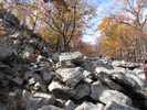
This trail is challenging in several ways - the climb to the summit up the east trail is a long scramble on a steeply slanted boulder field. A slip could easily result in an injury.
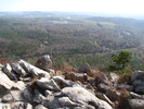
The challenge of the climb is well worth it - there is the tactile joy of climbing and the sublime joy of the world slowly widening below as you approach the summit.
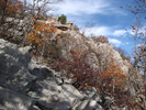
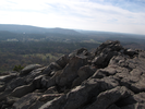
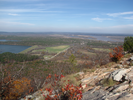
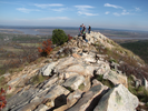
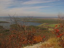
The summit is large and has stupendous vistas in all directions - there is almost nothing to limit the view.
The descent down the west side is fairly easy but still demands care - all in all this is a tough but excellent hike.
- Approach
-
From the junction of I-630 and I-430 in Little Rock Arkansas, follow I-430 2.4 miles north to the exit to Cantrell Rd (AR-10).
At the top of the ramp, turn left and follow Cantrell Rd. 6.6 miles west to AR-300.
At AR-300, turn right and go 2.0 miles north to the entrance to Pinnacle Mountain State Park.
Take a right into the park and find a spot near the Restrooms/Vending Machines
Coordinates for the hike: 34.8391270,-92.4930380
- Parking / Trailhead amenities
- The paved parking lot is huge with plenty of parking space. There are flush toilets, drinking fountains, picnic tables, vending machines, playground equipment, and quite a bit more adjacent to the parking lot.
- Trail observations
- The trailhead leaves from the parking lot a little east and across the lot from the toilet. You will climb a little, then pick up the base trail and begin walking around the base of the mountain counter-clockwise.
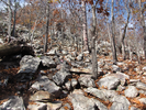
The trail alternates between dirt and picking your way through scree or small boulder fields. After going about a third of the way around the mountain, you will start ascending along the east summit trail at an easy slope, until suddenly you are at the base of a rocky landslide. If you are at all unsure about climbing up the landslide, this is the time to turn back.
Once you start up the landslide it is a continuous steep climb to the top. At the top there is plenty of room to move around to check out different vistas.
You'll descend from the summit via the west summit trail, which will lead you back to the parking lot. - Trail statistics
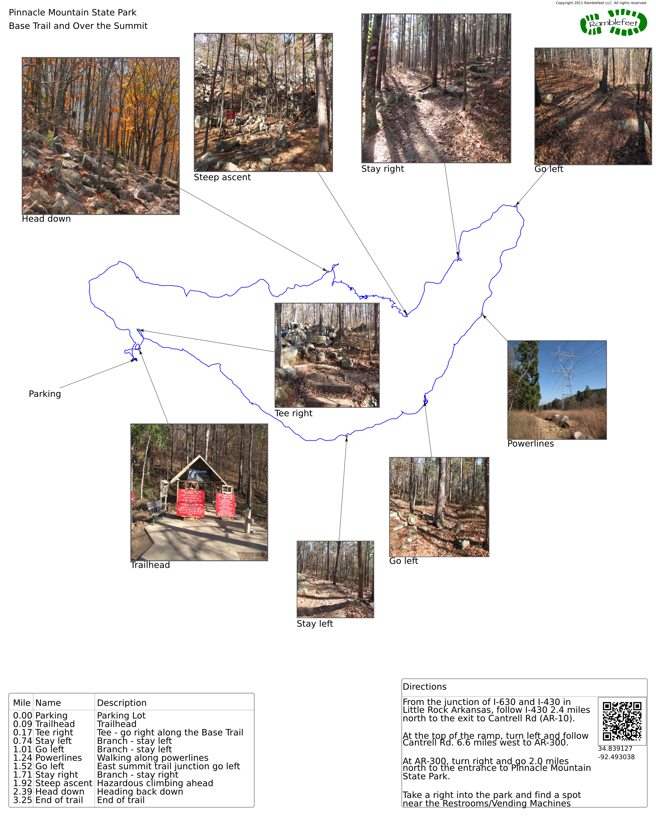
- The trail is 3.25 miles long. The sum of all the uphill climbs is 1185 feet.
- Trail waypoints
0.00 mi Parking Parking Lot 0.09 mi Trailhead Trailhead 0.17 mi Tee right Tee - go right along the Base Trail 0.74 mi Stay left Branch - stay left 1.01 mi Go left Branch - stay left 1.24 mi Powerlines Walking along powerlines 1.52 mi Go left East summit trail junction go left 1.71 mi Stay right Branch - stay right 1.92 mi Steep ascent Hazardous climbing ahead 2.39 mi Head down Heading back down 3.25 mi End of trail End of trail


- Keywords
- Difficulty: Difficult
- Feature: Rock climbing
- Terrain: Mountainous
- Trail surface: Dirt
- Trail surface: Rock
- Type: Loop
- View: Enclosed
- View: Open
- View: Wooded
- County: Pulaski
- State: Arkansas
- Country: United States of America
- Resources
- Printable trail map in PDF format (26 Mb download)
- Printable trail map in PNG format (4 Mb download)
- Waypoints in CSV format
- Waypoints in KML format
- Instructions on using a trail description page
- Instructions on using a trail map printout
- Trails in the surrounding area
- Trailheads for Arkansas Missouri, and Oklahoma (3 additional trails)
- Trailheads for Arkansas Mississippi, Missouri, and Tennessee (2 additional trails)
- Trailheads for Arkansas Louisiana, Oklahoma, and Texas (1 additional trail)
- Trailheads for Arkansas Louisiana, Mississippi, and Tennessee (1 additional trail)
Copyright © 2011 RambleFeet LLC. All rights reserved.