Father Hennepin State Park
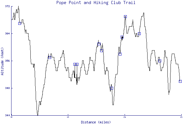
Pope Point and Hiking Club Trail

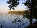
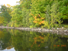
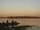
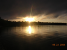
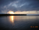
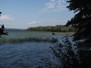
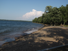
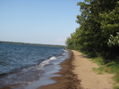
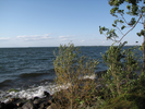
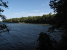
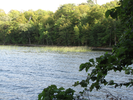
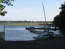
Every fall I try to visit Father Hennepin State Park for a walk along Mille Lacs Lake. The views are long, far off shores painted with birch and maple, rolling water colored blue from the enormous sky.
The wind blows hard across the water, pushing big waves that break along the shore. Geese calling, seagulls crying, waves crashing, all backdropped by the sighing of the wind are the sounds of the big lake.
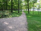
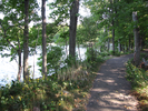
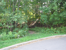
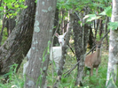
Away from the lake, the park is quiet, dark under a thick canopy of leaves in the dense forest. Walk quietly and let your gaze wander for a flash of white. Are you ready for a thrill?
- Approach
-
From the junction of interstate highway 169 and Minnesota Highway 27 north of Onamia Minnesota, follow MN-27 east 9.2 miles to the entrance to Father Hennepin State Park on the left in the town of Isle.
Follow the park road 1.2 miles to the parking lot for the beach and playground.
There is an entrance station shortly after you enter the park where you will need to pay a park entrance fee.
Coordinates for the hike: 46.1475240,-93.4966560
- Parking / Trailhead amenities
- The paved parking lot is large, paved, and level. Adjacent to the playground are pit toilets, a volley ball net, a playground, a picnic area, and a swimming beach.
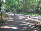
- Trail observations
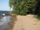
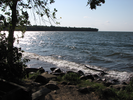
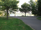
- The trail exits the parking lot headed towards the beach along a paved path. Turn left to do the first leg of the hike, a mile long out and back gravel trail to Pope Point. When you reach the picnic grounds on your return from Pope Point, cut across the mowed grass and continue along the sandy beach till you reach a small rocky point.
At the rocky point, leave the beach and continue following the shore, first on a paved trail, and then along a campground road. Continue all the way past the Lakeview campground, where you will finally leave the lake and head up a wooden staircase to the fish cleaning shelter.
At the fish cleaning shelter you will make a short right then left 'V' following the campground road. When you've reached the other side of the campsites, pick up the trail where it enters the woods. The trail makes a big arc through the woods and will bring you back to the parking lot.
The trail is flat, well kept, and easy to walk on. Walking on the beach can be a little hard because of the loose sand - luckily the distance isn't too long. - Trail statistics
- The trail is 2.98 miles long. The sum of all the uphill climbs is 155 feet.
- Trail waypoints
0.05 mi Parking Parking lot 0.10 mi Trailhead Trailhead 0.14 mi Go left Branch - go left towards the point 0.17 mi Keep right Branch - keep right towards the point 0.30 mi Bench Bench 0.62 mi Tee - go left Tee - go left 0.67 mi Turnaround Retrace your steps back to the beach 1.12 mi Go to beach Go to the beach and head towards the other point 1.16 mi Walk on beach Walk along the beach to the other point 1.38 mi Leave beach Leave the beach and follow the paved path left along the shore (bench) 1.47 mi Boat launch Boat launch 1.55 mi Floating dock Floating dock 1.58 mi Stay left Branch - stay left (map) 1.60 mi Bench Bench 1.78 mi Left on road Take a left and follow the campground road to the cul de sac 1.93 mi Climb stairs Climb the stairs to the fish cleaning shed 1.96 mi Go to the far side Trail is on the far side of campsites - may have to walk along the road to get there 2.02 mi Enter trail Take the gravel trail to the left of the sign 2.15 mi Cross road Cross the main park road and follow the trail 2.27 mi Bench Sign,Bench 2.34 mi Stay right Branch - stay right (map) 2.63 mi Stay left Branch - stay left (bench, sign) 2.71 mi Stay left Stay left along the curve (map) 2.83 mi Keep left Branch - keep left (bench) 2.94 mi Go right Tee - go right (map) 2.98 mi End of trail End of trail


- Keywords
- Difficulty: Easy
- Terrain : Flat
- Trail surface: Grassy
- Trail surface: Gravel
- Trail surface: Paved
- Trail surface: Sandy
- Type: Loop
- View: Open
- View: Shoreline
- View: Wooded
- County: Mille Lacs
- State: Minnesota
- Country: United States of America
- Resources
- Printable trail map in PDF format (35 Mb download)
- Printable trail map in PNG format (5 Mb download)
- Waypoints in CSV format
- Waypoints in KML format
- Instructions on using a trail description page
- Instructions on using a trail map printout
- Trails in the surrounding area
- Trailheads for Minnesota North Dakota, South Dakota, and Wisconsin (3 additional trails)
- Trailheads for Minnesota and Wisconsin (4 additional trails)
- Trailheads for Minnesota North Dakota, South Dakota, and Wisconsin (9 additional trails)
- Trailheads for Iowa Minnesota, and Wisconsin (9 additional trails)
Copyright © 2011 RambleFeet LLC. All rights reserved.