Capulin National Monument
Rim Trail
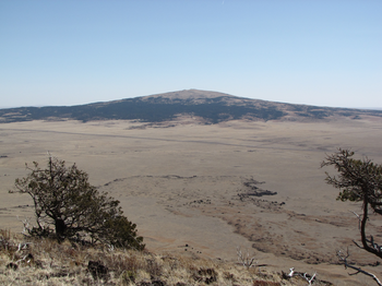
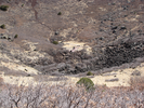
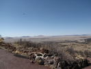
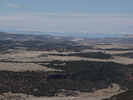
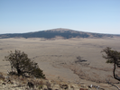
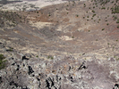
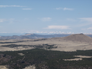
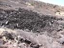
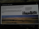
The Crater Rim Trail is a short but spectacular tour of a dormant volcano. Every step along the rim has views to incredible distances. Far off you can see the Rockies, and nearer you can see several other volcanoes in the surrounding 8,000 square mile volcanic field. If you can stop looking outward, views into the interior of the volcano show the depths of the caldera. This is an amazing drive to an amazing hike.
- Approach
-
From the junction of US Hwy 64 and NM-325 in Capulin New Mexico, drive 2.8 miles north to the Capulin National Monument road. Take a right and follow the road 2.1 miles around the volcano to the parking lot near the top. Note that the road to the top of the volcano is closed when the monument is closed. Check the NPS web site for times when the road is open.
You will need to pay an entrance fee to enter the monument. There is a visitor center 0.4 miles after you enter the monument. There are clean restrooms, water, books and other souvenirs available there.
Coordinates for the hike: 36.7825800,-103.9721840
- Parking / Trailhead amenities
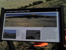
- The parking lot at the trailhead is paved and level and has room for quite a few cars. There is a clean pit toilet, a map board, and several informational signs. The view from the parking lot is spectacular. The rim trail exits directly from the parking lot on the side opposite where the park road enters.
- Trail observations
- Both the rim and crater trails are paved, and generally are either slanting up or down, often times steeply. There is not a lot of level travel on this trail, nor is there any shade. Take your time - there are plenty of benches and plenty of things to see. Note that the trail is at a fairly high altitude with few windbreaks. If you wear a hat, make sure it's on firmly!
- Trail statistics
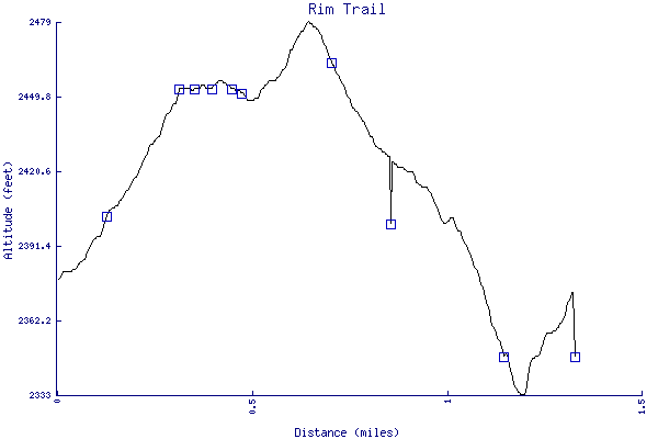
- The trail is 1.33 miles long. The sum of all the uphill climbs is 159 feet.
- Trail waypoints
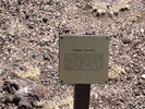
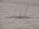
0.00 mi Trailhead Trailhead 0.10 mi Far off Far, far, view 0.11 mi Snow caps Snow capped mountains 0.13 mi Bench 1 Bench 0.32 mi Bench 2 Bench 0.36 mi Sign Sierra Grande Sign 0.36 mi Sierra Grande Sierra Grande 0.38 mi Parking view Crater and parking lot 0.40 mi Bench 3 Bench 0.45 mi Windmill Windmill out in the desert 0.45 mi Bench 4 Bench 0.48 mi Bench 5 Bench 0.54 mi Bench 6 Bench 0.61 mi Bench 7 Sign and Bench 0.71 mi Bench 8 Bench 0.85 mi Bench 9 Bench 0.86 mi Vista Wonderful vista 1.01 mi Crater trail Head down the crater trail 1.15 mi Bottom Bottom of the crater 1.33 mi End of trail End of trail

- Keywords
- Difficulty: Moderate
- Terrain : Mountainous
- Trail surface: Paved
- Type: Loop
- View: Open
- County: Union County
- State: New Mexico
- Country: United States of America
- Resources
- Printable trail map in PDF format (12 Mb download)
- Printable trail map in PNG format (3 Mb download)
- Waypoints in CSV format
- Waypoints in KML format
- Instructions on using a trail description page
- Instructions on using a trail map printout
- Trails in the surrounding area
- Area map for Colorado and New Mexico (No additional trails)
- Area map for Colorado and New Mexico (No additional trails)
- Area map for Colorado, Kansas, New Mexico, Oklahoma, and Texas (No additional trails)
Copyright © 2011 RambleFeet LLC. All rights reserved.