Blue Ridge Parkway
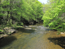
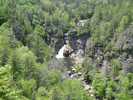
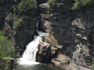
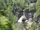
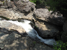
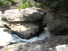
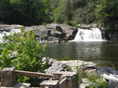
Linville Falls
To me Linnville Falls is a sunny warm day spent strolling through tall trees, pink and white blossoms showing in the dappled sunlight, my son and I alternating between quiet conversation and easy companionship.
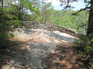
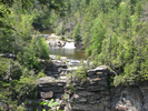
We passed all the sidetrails to the overlooks on the way up, mutually agreeing that we wanted to see them from the highest vantage first. When we arrived at the farthest overlook, we knew we had made the right choice.
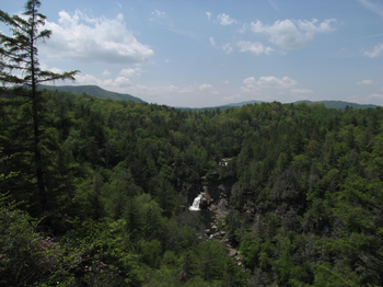
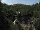
Whoever chose the location and design of this outlook achieved perfection. Sunlight and breeze and a wonderful view of the falls and the surrounding mountains - this is a great place to simply sit and enjoy, which is what we did for quite a while.
Coming back down we visited the other overlooks in turn and these too were rewarding, each in their own way. This is a wonderful, peaceful hike - enjoy.
- Approach
-
Linville Falls is at Blue Ridge Parkway Milepost 316.4, which is about 66 miles northeast along the parkway from Asheville, North Carolina.
Coordinates for the hike: 35.9549100,-81.9281010
- Parking / Trailhead amenities
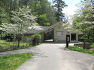
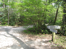
- The parking lot is paved, smooth, and has plenty of capacity. There is a visitors center at the end of the parking lot that has exhibits, gifts, clean restrooms, and a drinking fountain.
- Trail observations
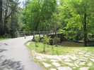
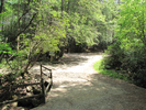
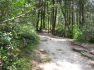
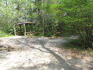
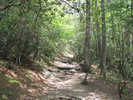
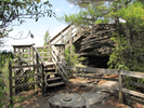
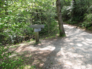
- The trailhead starts at the visitor center. Exit the visitor center and head right across the bridge. I recommend bypassing all the overlooks on the trail until you reach the end, then visiting them all on the way back down. The trail is in good condition, although there are roots across the trail in some areas.
It's a mildly strenuous hike if you go to the last overlook. Luckily, reaching the first overlook is easy, so you can choose your level of exertion on this hike! - Trail statistics
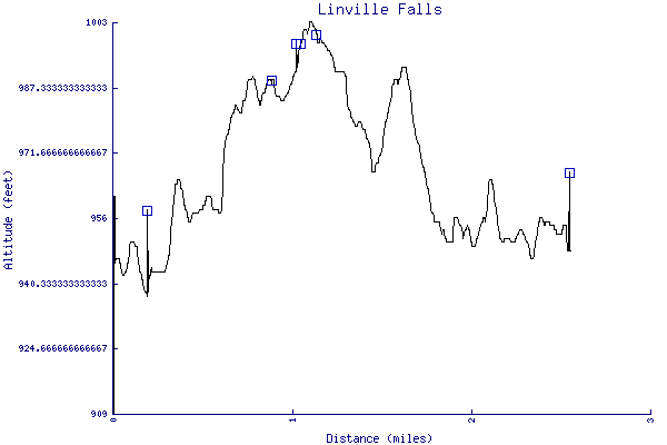
- The trail is 2.55 miles long. The sum of all the uphill climbs is 190 feet.
- Trail waypoints
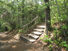
0.08 mi Trailhead Visitors Center 0.19 mi Cross bridge Go right across bridge 0.60 mi Stay right Branch - stay right 0.89 mi Go right Branch - stay right towards Erwin View 1.03 mi Valley view Near the top 1.06 mi Small steps Take the stairs 1.13 mi Stairs Go up the stairs to the overlook 1.14 mi Turnaround Return the way you came, visiting all the overlooks 2.55 mi End of trail End of trail


- Keywords
- Difficulty: Easy
- Feature: Waterfall
- Terrain : Hilly
- Trail surface: Dirt
- Type: Out-and-back
- View: Enclosed
- View: Overlooks
- County: Burke
- State: North Carolina
- Country: United States of America
- Links
- Blue Ridge Parkway.org. Great site for preparing to travel the Blue Ridge Parkway.
- Blue Ridge Parkway Hikes site
- Cawtawba Riverkeeper site
- National Park Service site for the Blue Ridge Parkway
- PDF map of the Blue Ridge Parkway
- Resources
- Printable trail map in PDF format (21 Mb download)
- Printable trail map in PNG format (4 Mb download)
- Waypoints in CSV format
- Waypoints in KML format
- Instructions on using a trail description page
- Instructions on using a trail map printout
- Trails in the surrounding area
- Trailheads for Kentucky North Carolina, Ohio, Tennessee, Virginia, and West Virginia (No additional trails)
- Trailheads for Georgia Kentucky, North Carolina, South Carolina, Tennessee, Virginia, and West Virginia (2 additional trails)
- Trailheads for Georgia Kentucky, North Carolina, South Carolina, Tennessee, Virginia, and West Virginia (1 additional trail)
- Trailheads for Georgia North Carolina, South Carolina, and Tennessee (1 additional trail)
- Trailheads for Georgia North Carolina, South Carolina, and Tennessee (1 additional trail)
Copyright © 2011 RambleFeet LLC. All rights reserved.